Canary Islands Declare an End to Outdated Maps
The Canary Islands have had enough of imprecise, antiquated maps anchored in the last century. The Department of Territorial Policy, led by Manuel Miranda, is activating a quiet revolution: the creation of a millimetre-precise digital map of the archipelago’s 148 protected natural spaces. Next Monday, 6 April, the Law for the Digitalisation of Natural Spaces will be released for public consultation. This legislation will, for the first time, provide a high-precision digital map—based on geographic information systems and satellite technology—of all 148 protected areas.
Leaving Paper Maps Behind
For nearly four decades, the boundaries of these spaces—which cover close to 40% of the Canary Islands—have been defined by 1987 paper plans, integrated as legal annexes since 1994. In the heart of the 21st century, these paper maps are as obsolete as they are inadequate for the territory’s complexity and technological advances. The new law introduces digital cartography based on geographic information systems and satellite technology, allowing for clear, exact, and accessible boundaries for everyone.
Correcting a Decades-Old Anomaly
The archipelago has been burdened for decades by a system inherited from the 1994 Natural Spaces Law, which incorporated annexes for reclassification and cartography to define protected areas from the previous 1987 legislation. That formula responded to the context of its time and allowed for the legal organisation of the natural spaces network. However, the passage of time, the expansion of digital administration, and the widespread use of geographic information systems have rendered the material foundation of those boundaries obsolete.
Today, practically any instrument for territorial planning is processed digitally. So too are the public databases that coordinate information at the state and European level. And yet, an essential part of the Canary Islands’ environmental architecture remained anchored to a format that no longer communicates fluently with that digital reality. The new regulation aims to correct this anomaly and make the boundaries of natural spaces compatible with the digital ecosystem of contemporary territorial planning.
From Rotring Pens to Satellite Precision
The Director-General of Territorial Planning and Cohesion, Onán Cruz, explains with a graphic example: “Before, you would draw the border with a set square, a ruler, and a Rotring pen with a 0.8mm nib. It looked perfect until you zoomed in on the paper map and saw upon enlargement that the thickness of the line was four metres wide on the ground, meaning it either encroached on private property or private property encroached on the protected territory.” Now, with the digital satellite map, “boundaries are established to the millimetre no matter how much you zoom in. There is no longer any room for error,” states Cruz.
Legal Certainty for Landowners
This is no minor milestone. In a community fragmented across eight islands, with fragile territory, enormous landscape diversity, and strong pressures on land use, every cartographic stroke has administrative, environmental, and social repercussions. Or, as the Director-General explains, “This will now prevent infringements due to oversights based on cartographic errors.”
“A misinterpreted line can affect licences, projects, agricultural uses, urban plans, or property rights. A precise, accessible, and standardised line reduces conflicts and provides certainty,” insists Cruz. Therefore, the legal text provides greater legal security for those with properties on the margins of these spaces. This is one of the most powerful points of the text: it turns cartography into a tool of public clarity because what may now be cumbersome or ambiguous will become better defined, more accessible, and better coordinated between administrations.
A Long Road to Modernisation
The processing of this law has been a long time coming. A first legislative process was initiated in October 2018. The procedure advanced with public consultation and reports, but after consultations resumed in 2021, the previous government did not complete the process. Subsequently, technicians from the Department, seeing the paralysis and the entry into force of a 2023 law, considered it preferable to start a new process, also incorporating the 165 suggestions made during previous periods of public consultation.
The new push was formalised in February 2025, when the Governing Council approved the opportunity report to restart the drafting of the law. This was followed by mandatory reports, and now the public consultation phase opens. The planned schedule involves resolving objections, sending the file to the Consultative Council, and later, after the summer, sending the bill to Parliament for debate and final approval.
A Law for an Evolving Network
The context is also not coincidental. The Canary Islands Network of Natural Spaces continues to evolve. Currently, the expansion of Cumbre Vieja in La Palma and the incorporation of two new spaces linked to lava deltas—Costa del Guirre and Costa del Perdido—are being processed. Furthermore, preliminary work is beginning on the future natural space of Volcanes de Rosiana in Gran Canaria.
The great political and symbolic strength of this law lies in the fact that it does not modify the map, but modernises the way of seeing it. It does not change the network of natural spaces, but it does enhance the capacity to manage it with greater rigour.


New indicator reveals sea temperature rise around Canary Islands

Emergency backpack: what to pack for a quick evacuation
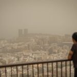
Saharan dust levels rise in Europe, study finds

Tenerife paves way for green hydrogen at Granadilla port

Green light for Tenerife’s Güímar pumped-storage hydro plant

Beach closures in Canary Islands signal sewage crisis

Green meteor lights up the sky over the Canary Islands
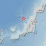
Three earthquakes recorded in Canary Islands this weekend

Quevedo mural appears on abandoned Tenerife hotel