
Compiled with the help of artificial intelligence, based on Spanish-language information. Source below the article.
An unstable day across the archipelago
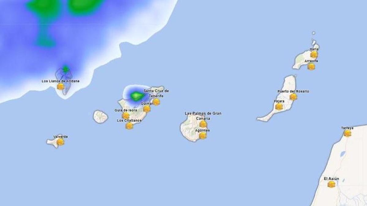
The State Meteorological Agency (Aemet) forecasts a markedly unstable day of weather across the Canary Islands this Monday. Skies will remain covered by a dense layer of medium and high cloud, accompanied by a fairly significant episode of calima, affecting mainly mid-altitude and summit areas facing south. Aemet also does not rule out scattered rainfall and the formation of isolated storms, particularly in the interior and at higher altitudes of the islands with the greatest relief.
Temperatures climb to 34°C in places
As for temperatures, values will rise across the board, with the increase especially pronounced in the maximums on the northern slopes of the mountainous islands and in inland areas of the eastern Canaries. Thermometers will fluctuate between 30 and 33°C across large parts of the archipelago, occasionally reaching a maximum of 34°C in the north of Lanzarote, Fuerteventura and La Graciosa during the central hours of the day.
Two distinct wind scenarios
Wind behaviour will show two clearly differentiated scenarios. In the eastern islands it will blow from an easterly direction, with occasionally strong intervals on the western slopes during the early hours, easing to light and variable from midday onwards. Across the rest of the region, light sea breezes will predominate along the coasts, while in mid-altitude and summit areas the wind will veer to a southerly component of moderate to strong intensity, with a likelihood of very strong gusts in the central summits of Tenerife towards the evening.
Rough seas and reduced visibility
Sea conditions will reflect the impact of the poor weather. An easterly and north-easterly wind of force 4 to 5 is forecast, reaching force 6 offshore, although it will tend to ease late in the evening. Along the south and south-west coasts, by contrast, light variable winds and calm seas will prevail. Aemet warns of a northerly swell with waves of up to two metres, along with showers reducing visibility to moderate or poor along the coastline of the western islands.
Tenerife
Covered skies with a chance of scattered rainfall and instability with isolated storms in the higher areas of the north. Temperatures rising in mid-altitude areas, with local readings of 30°C in the south, east and northern coast. Moderate to strong southerly wind on the summits, with very strong gusts at the highest altitudes at the end of the day. Santa Cruz de Tenerife will register between 22°C and 30°C.
La Palma, La Gomera and El Hierro
Overcast skies with calima at higher altitudes and a risk of light or occasional rain that could be accompanied by storms. The rise in maximum temperatures will be notable in mid-altitude areas of the north. San Sebastián de la Gomera will reach a maximum of 28°C, Valverde 23°C, and La Palma is expected to see a pronounced upturn in daytime values.
Lanzarote and Fuerteventura
Skies tending to become fully covered by medium and high cloud, accompanied by calima at high levels. Minimum temperatures will remain without major changes, while maximums will rise notably inland and in the north, reaching 30-33°C and possibly touching 34°C locally. In Arrecife and Puerto del Rosario, readings will range between a minimum of 21°C and a maximum of 28°C on the coast.
Gran Canaria
Very cloudy skies with calima in mid-altitude and summit areas facing south. The temperature rise will be felt especially in mid-altitude areas of the north and east, with 30°C exceeded in inland areas. Easterly wind along the coasts, easing throughout the day. In Las Palmas de Gran Canaria, values will sit between 22°C and 28°C.
What’s happening in the Canaries – straight to your phone
News, weather alerts and practical updates – direct from the islands, in English. We live here and know what’s going on – before the international media catch up. Everything lands on our WhatsApp channel – no middlemen, no algorithm. Curated for families, expats and travelers.

Monday: calima and 34C heat across the Islands

Sunday: calima and 30°C as alisio winds strengthen

Calima and 30C heat to hit the Canary Islands this Sunday

Calima and 30°C heat to hit the Canary Islands this Sunday

Friday: trade winds return and skies clear

Rain alert declared for three Canary Islands from midnight

Thursday: heavy showers fade as calima drifts in

Canary Islands on alert as heavy rain warnings escalate

Rain alert declared for El Hierro as La Palma stays on pre-alert
