
Compiled with the help of artificial intelligence, based on Spanish-language information. Source below the article.
Calima set to dominate the day
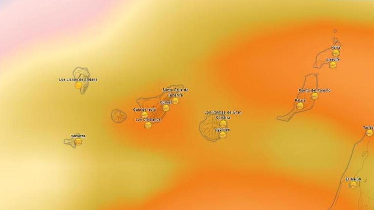
The State Meteorological Agency (Aemet) is forecasting a Sunday marked by intervals of medium and high cloud across the whole archipelago, with cloudy skies in the early hours in low-lying areas of the north of the mountainous islands. The phenomenon that will set the meteorological tone of the day, however, will be calima, which will make itself felt most significantly above 800 metres, particularly on south-facing slopes and at high levels of the eastern islands.
Temperatures climb past 30°C
On the temperature front, minimums will remain largely unchanged, while maximums will rise slightly to moderately, especially in the mid-altitude areas. This upturn will push thermometers locally past the 30°C mark at inland spots in southern Lanzarote and on the south and west-facing slopes of Gran Canaria during the central hours of this Sunday.
Strong northeast winds and rough seas
As for the wind, it will blow from the northeast with strong intervals in exposed coastal areas, and very strong occasional gusts cannot be ruled out in the early hours at the southeastern and northwestern extremes of the western islands. With altitude, the wind will tend to veer towards the southeast and south in mid-altitude areas and at the summits, where it may blow strongly in exposed areas of the Tenerife ridge and the summits of El Hierro.
Along the coast and on the open sea, the maritime situation will be dominated by northeast winds of force 5 or 6, occasionally strengthening to force 7, generating choppy, rough or very rough seas. On the southern and southwestern coasts, by contrast, light variable winds and slight seas will predominate, accompanied by a northerly swell with waves of between one and two metres.
Tenerife
Predominantly medium and high cloud, with low cloud in the north early in the day. Calima will be prominent in mid-altitude areas and at summits facing south. Temperatures will rise in mid-altitude areas, with very strong wind gusts in the southeast and northwest at the start of the day. Santa Cruz de Tenerife is expected to see between 22°C and 27°C.
La Palma, La Gomera and El Hierro
Clear skies or high cloud, except in the north, where low cloud will predominate early on with the chance of light rain in La Palma. Light calima will intensify in the afternoon at higher altitudes. San Sebastián de la Gomera will reach 28°C, Santa Cruz de la Palma 26°C and Valverde will range between 17°C and 21°C.
Gran Canaria
Cloudy skies in the north at dawn and intervals of medium and high cloud for the rest of the day. Calima in mid-altitude areas and at summits, being noticeable in the south. Maximums will rise sharply inland, exceeding 30°C on the south and west-facing slopes. In Las Palmas de Gran Canaria, values will range between 22°C and 26°C.
Lanzarote and Fuerteventura
Skies with cloudy intervals and calima at high levels. Maximum temperatures will rise slightly in the inland south of Lanzarote, where 30°C will be reached locally. Arrecife and Puerto del Rosario will register minimums of 21°C and maximums of 26°C.
What’s happening in the Canaries – straight to your phone
News, weather alerts and practical updates – direct from the islands, in English. We live here and know what’s going on – before the international media catch up. Everything lands on our WhatsApp channel – no middlemen, no algorithm. Curated for families, expats and travelers.

Friday: trade winds return and skies clear

Rain alert declared for three Canary Islands from midnight

Thursday: heavy showers fade as calima drifts in

Canary Islands on alert as heavy rain warnings escalate

Rain alert declared for El Hierro as La Palma stays on pre-alert

Wednesday: showers and unstable air across the Islands

Tuesday: heavy showers and storms in El Hierro

El Hierro issued yellow warning for heavy rain

Monday: autumn showers and a cooler feel
