
Stable Sunday ahead for Tenerife
Tenerife is preparing for a Sunday marked by stable weather, light calima at high altitudes and north-easterly winds. The State Meteorological Agency (Aemet) forecasts mostly clear or cloudless skies across the island, although there will be some cloudy intervals in the northern coastal strips, particularly during the early and late hours of the day.
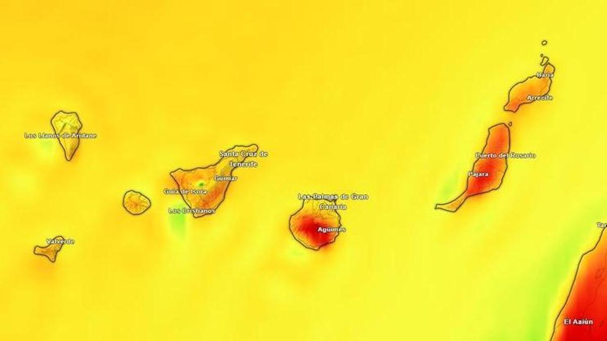
The day will bring no major changes in temperatures, though slight rises in maximums are expected in inland areas of the south and west. In Santa Cruz de Tenerife, thermometers will range between 24°C as a minimum and 30°C as a maximum. The calima will be light and remain at altitude, meaning no particularly intense episode is expected at ground level. Even so, it may leave the sky somewhat hazy and reduce visibility at times, especially in exposed areas.
Heat and cloud contrasts across the island
Aemet does not rule out localised highs of 30°C on the southern coasts of the metropolitan area and in the south of Tenerife. The heat will be more noticeable in sunny, sheltered areas facing south, while the north will see more cloudy intervals during the early and late hours. The predicted scenario points to a typical summer’s day on the island: stable conditions, open skies across much of the territory, and contrasts between the different slopes. In the north, low clouds associated with the trade winds could slightly moderate temperatures. In the south and west, the sun will take centre stage.
Strong winds in the southeast and northwest
Wind will be one of the most notable elements of the forecast. The trade winds will blow moderate but will be strong in the lower areas of the southeast and the far northwest of Tenerife. Occasionally very strong gusts cannot be ruled out in these spots. In the west of the island, breezes will predominate, leaving calmer conditions in sheltered areas. This difference is typical of Tenerife when the trade wind accelerates through coastal corridors and loses strength on protected slopes.
Sea conditions and visibility
At sea, the forecast for Canary Islands coastal waters points to north or north-easterly winds of force 4 or 5, increasing to force 6 and 7 in some areas. Moderate to rough seas are expected, with a north-easterly swell of 1 to 2 metres and visibility ranging from moderate to poor due to calima. Mostly clear or cloudless skies, with intervals in northern coastal strips during the early and late hours. Light calima at high altitudes, no major temperature changes, and the possibility of localised 30°C in the south and southern coasts of the metropolitan area. Moderate trade winds, with strong intervals in the southeast and far northwest.
Forecast for the other islands
Clear skies, with intervals in the lower areas of the north. Maximums will rise slightly in the interior of the south and west, where they could reach between 32°C and 34°C. The trade winds will blow strongly in the southeast and northwest, with occasional very strong gusts.
In Lanzarote, mostly clear skies will prevail, with intervals in the west during the early and late hours. Reaching 30°C in the southeast cannot be ruled out. In Fuerteventura, the southern half may exceed that figure, with strong winds south of Jandía. La Gomera will have clear skies, intervals in the north, and very strong gusts on the southeast and western slopes, especially towards the end of the day. In La Palma, there will be intervals in the lower areas of the north and east, with occasionally strong trade winds. El Hierro is expected to have clear skies, intervals in the north, and strong winds in the southeast and northwest.
What’s happening in the Canaries – straight to your phone
News, weather alerts and practical updates – direct from the islands, in English. We live here and know what’s going on – before the international media catch up. Everything lands on our WhatsApp channel – no middlemen, no algorithm. Curated for families, expats and travelers.

Tuesday: heavy showers and storms in El Hierro

El Hierro issued yellow warning for heavy rain

Monday: autumn showers and a cooler feel

Sunday: scattered clouds and showers on the islands

Saturday: cooler air and clearing Saharan dust

Canary Islands weather: rain and storms on the way

Friday: summer heat before an autumnal weekend

Tuesday: cloud, showers and a building swell

Monday: cloud cover and scattered showers
