Study Predicts Drastic Increase in Canary Islands Heat Waves
A study from the University of La Laguna (ULL) forecasts a drastic increase in heat waves across the Canary Islands as the century progresses towards 2100, determining they will become increasingly frequent, prolonged, and extreme. According to the State Meteorological Agency (Aemet), a heat wave is a prolonged period of abnormally and extremely high temperatures for a region, sustained for at least three consecutive days. In recent decades, and as a consequence of climate change, this phenomenon has increased in frequency, duration, and intensity across the Iberian Peninsula and the Canaries.
Key Indicators and Projected Impacts
In the study Climate projections of intensifying heat waves in the Canary Islands by 2100 (Spain), published in the journal Regional Environmental Change and led by Juan Carlos Santamarta Cerezal from ULL’s Department of Agricultural and Natural Environment Engineering, four key indicators of these events were evaluated: frequency, average duration, average intensity, and maximum intensity.
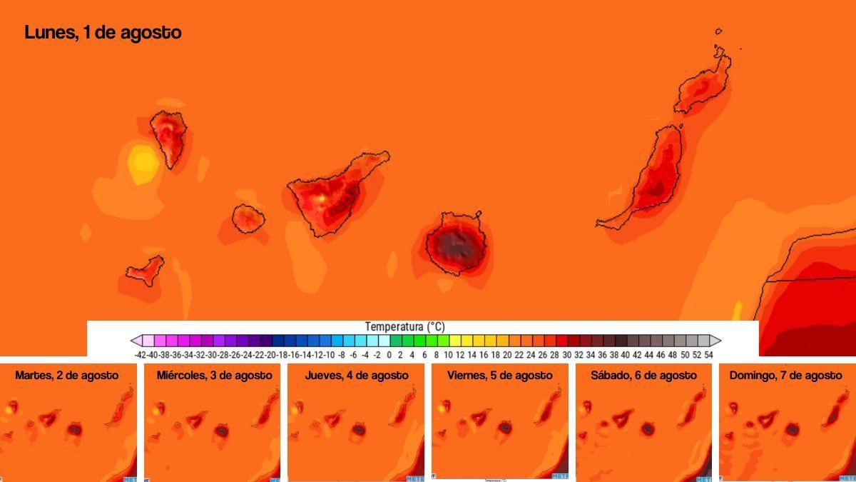
Currently, the average duration of a heat wave in the islands ranges between 4.4 and 5.5 days, depending on the island. However, projections indicate that by the end of the century, up to ten consecutive days of extreme temperatures could be recorded in the worst-case scenarios. The total annual accumulation of extreme heat days could exceed 60 days in the case of La Palma.
Western Islands to See Greatest Temperature Rises
Regarding the intensity of heat waves, the results show that while the average temperature during these events will not increase significantly, the maximum intensity could experience a notable rise. In particular, the western islands such as El Hierro and La Palma would record increases of up to +1.4°C in the maximum temperature of these episodes under the most critical scenarios.
According to the research group, these projections show a greater maximum intensity in the western islands. This is due, at least in part, to the fact that in territories with more complex topography, the relief interacts with atmospheric factors, such as the thermal inversion, which can intensify temperature increases.
Geographical Vulnerability and Broader Consequences
The research notes that the archipelago’s position on the boundary between temperate and subtropical climates makes it especially vulnerable to intrusions of warm air masses from the African continent, particularly from the Sahara Desert. The researchers add that the complex island topography and the influence of the cold Canary Islands coastal current also interact to modulate the spatial variability, intensity, and persistence of heat waves across the islands.
In terms of frequency, the study shows a notable increase in the annual number of heat episodes across all islands, with differences depending on location and proximity to Africa. The authors warn that this projected increase will have important repercussions for public health, water resource management, and economic activity, especially in sectors such as agriculture and tourism.
Calls for Adaptation and Mitigation Strategies
Based on the results obtained, the research group considers it necessary to develop appropriate mitigation and adaptation strategies. These should include optimising urban planning, improving water management, and implementing protective measures for the most vulnerable sectors of the population.
This research is part of the European project ARSINOE, through which the SICMA Canarias platform has been developed as a viewer for consulting local climate change scenarios in the Canary Islands. Finally, the ULL highlights that this project has recently been granted the 2026 Chris Binnie Award for Sustainable Water Management.
Canary Islands heatwave: Temperatures to hit 37°C
Wednesday: stable alisios, calima, and strong gusts
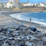
Tenerife beaches closed: raw sewage and E. coli fears
Fuel spill prompts marine pollution alert in Gran Canaria
Tuesday: Strong winds and a calima haze
Monday: summer sun, strong winds, and calima aloft
Tenerife weather: stable Sunday with calima and strong winds
Sunday: Saharan dust and gusty trade winds
Saturday: calima and strong winds for the weekend