First smart surveillance tower installed in Tenerife
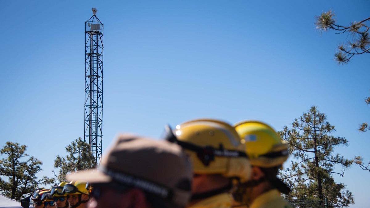
Wildfire prevention in Tenerife has taken a significant step forward with the installation of the first fully sensorised tower for detecting fires in natural areas. The tower, located at Los Topos in Vilaflor, is the first of six structures equipped with a camera featuring thermal and visible sensors capable of identifying heat sources, reducing false positives as its artificial intelligence improves through training, and feeding real-time information to Cecopin, the Island Operational Coordination Centre.
The new system was unveiled on Monday alongside the rest of the deployment during the presentation of the Tenerife Cabildo’s wildfire prevention campaign in Chasna. The Los Topos tower represents a shift away from traditional surveillance models for fire detection. The installed camera operates with energy autonomy and multiple connection types, ensuring it continues functioning and reporting essential data for strategic fire response regardless of circumstances.
‘Intelligent node’ for island-wide forest monitoring
The ambition with these devices is to monitor 90 percent of Tenerife’s surface once fully deployed in the coming months. “Los Topos is an intelligent node of the future island forest surveillance network. It is a 25-metre-high tower with energy autonomy based on photovoltaics, 48 hours of storage, and a backup generator. It has everything necessary to operate 24 hours a day,” said David Pérez, head of the technical service for the Cabildo’s Innovation department.
The installations are another piece in the puzzle of the Smart Emergency Management System (SIGE). Pérez explained that the aim is “to apply technology and innovation to protecting people, the territory, and the natural environment.” Furthermore, this elevated surveillance mechanism will also be linked to volcanic, hydrological, and meteorological risk monitoring, as it incorporates a small weather station to provide all these variables to Cecopin. This information is transmitted through a software programme developed by the Cabildo’s Innovation department.
Smarter decisions with satellite data from 2028
“It will help us make better decisions to prevent and intervene in a fire,” said area councillor Juan José Martínez (Coalición Canaria). The project is pioneering, and Martínez emphasised it does not end with the installation of sensorised cameras on towers. “From 2028, we will incorporate information provided by the Canary Islands satellite constellation, so that Cecopin technicians have daily data on fuel mass, land moisture, or areas with greater potential fire risk,” he added.
760 personnel deployed for the coming months
The rest of the wildfire fighting deployment for Tenerife in the coming months comprises 760 people. This includes an additional 30 Brifor forest firefighters compared to 2025, bringing the total to 180 personnel. A night shift of 32 firefighters has been established, which can be increased to 50 during high-temperature alerts or maximum alerts. During the day, 80 forest firefighters will be on duty.
Army patrols will be redeployed to reinforce the mid-altitude areas of southern Tenerife, considered the zone of highest seasonal fire risk. Military presence in the island’s deployment is again made possible thanks to the third edition of Operation Prometeo, which will run for three months with ten daily patrols. Eleven forestry engineers from the Cabildo itself will be involved, along with three more assigned to command and coordination. There will also be 12 environmental agents from the island corporation, plus Gesplan personnel: 33 technicians, five brigade teams, and 92 additional firefighters. The Firefighters’ Consortium contributes around 250 people.
Drones, helicopters and new water tankers
On the equipment front, 12 drones from the Cabildo have been incorporated, which demonstrated their capabilities during the presentation. They are equipped with thermal cameras, coordinate location, heat source tracking, hotspots, and support for night fires. These drones will not operate alone, as Army drones will also be deployed.
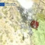
The Cabildo has two firefighting helicopters, which gave a small demonstration of their capability by collecting water from the Trevejos reservoir, directly below Los Topos, and discharging it over the nearby pine forest. An additional 19 aerial resources are provided by the Government of the Canary Islands.
Light forest fire engines are pickup-type vehicles. Brifor has 24 such vehicles, which are supplied with water by two tanker fire engines with a capacity of 9,000 litres. The main function of these tankers is to prevent the smaller vehicles from having to travel to other points to refill. Thanks to the large volume of water they can store, they serve as mobile reservoirs and shorten extinction times by eliminating journeys to source water. Heavy forest fire engines are also available: 20 in total, with three more expected by the end of the year.
‘The best fire is the one that never happens’
The president of the Cabildo of Tenerife, Rosa Dávila (Coalición Canaria), stated: “After the fire we had in 2023, we were determined not to let something like that happen again and to have all available resources, both human and material. I want to highlight that this year we have made an effort to incorporate digital resources. That is why we are here, at this Los Topos tower, which is the first fully sensorised tower.”
Meanwhile, the councillor for Natural Environment, Sustainability, Safety and Emergencies, Blanca Pérez (Coalición Canaria), said: “Our objective is that there are no large fires. The best fire is the one that never happens. And if it does happen, we want to have the best teams to monitor it, arrive quickly, arrive with strength, and prevent it from becoming a large fire.”
What’s happening in the Canaries – straight to your phone
News, weather alerts and practical updates – direct from the islands, in English. We live here and know what’s going on – before the international media catch up. Everything lands on our WhatsApp channel – no middlemen, no algorithm. Curated for families, expats and travelers.

Earthquake felt in Tenerife and Gran Canaria

Rare deep-sea codlet confirmed in Canary waters for first time

Tenerife faces summer with just two campsites amid outdoor tourism boom

Canary Islands to get first dedicated biodiversity law

Tenerife seismic activity: 550 events recorded in 24 hours

Contigo La Palma slams ‘unethical’ banana aid compensation

Canary Islands observatories get major data network boost
Energy storage framework finally approved for Canary Islands

US military hub near Canaries: what it means for Spain