A Damp and Chilly Spring Ahead
The beginning of spring in the Canary Islands will be marked by three weeks of weather that is rainier and colder than usual. Flowers will have to wait a little longer to bloom and add a splash of colour to the islands, as the forecasts for March show the archipelago is not yet ready to forget a winter that, despite the widespread feeling, has not been as cold as might be expected.
Winter 2025-2026: The Coldest in Five Years
The State Meteorological Agency (Aemet) in the Canary Islands has summarised the just-ended season as “normal” for temperatures and “wet” for rainfall. The average temperature this trimester was 15.4°C, which is 0.2 degrees above the norm. However, the winter of 2025-2026 has been the coldest and rainiest of the last five years, resembling in its characteristics the pandemic winter of 2020-2021, though still far from being as wet as 2009-2010 or as cold as 2008-2009.
This Canarian winter was dominated by an endless train of Atlantic storms. Bram, Emilia, Francis, and Ingrid became essential players in bringing cold and rain to the archipelago. Despite helping to pull the islands out of the long-running drought they had been suffering, they were not enough to stop the global climatic trend towards heat.
A Tale of Two Halves: From Stormy to Saharan
While the average temperature in the islands remained below normal values in December and January, the atmospheric situation in February changed everything. The last month of the winter trimester was characterised by stabilising weather thanks to the Azores High, which allowed temperatures to rise naturally. The heat, however, intensified at the end of the month with the intrusion of a Saharan air mass and calima.
Consequently, the winter flirted with extremes. During this period, the archipelago’s thermometers oscillated between anomalies of 4.4 degrees below and up to 5 degrees above normal.
December: The Coldest and Wettest Month
The coldest and rainiest month was December. The average temperature was 15.7°C with a negative anomaly of -0.7°C, giving it a “very cold” character. Minimum temperatures of -2.9°C were recorded in the high mountains of Tenerife, specifically at Izaña. It was also notably cold in mid-altitude areas, with places like El Sauzal in Tenerife recording lows of just 1.3°C.
The coldest, rainiest, and windiest days were linked to Storm Emilia (10th to 14th December), when temperatures were recorded at four degrees below normal, with wind gusts of up to 153 kilometres per hour and rainfall accumulations of up to 150 litres per square metre in a single day. This was the case in Vega de San Mateo in Gran Canaria, which became the rainiest area of the month. However, Candelaria in Tenerife was the municipality where it rained the most in one day: 51 litres per square metre on 13th December.
January: Record Low Temperatures
The thermometers did not recover in January. With an average temperature of 14.5°C and a thermal anomaly of -0.3°C, the start of the year was also classified as “cold”. This month saw the lowest minimum temperature of the winter in the Canaries. Specifically, at Izaña, the weather station recorded -4.1°C on 7th January. In the mid-altitudes, it was the municipality of El Paso in La Palma that registered the lowest temperature: 2.2°C.
January did not surpass December in total rainfall, but it did exceed expectations by a greater margin, raining 86% more than expected.
February’s Abrupt Change to Warmth
The situation changed abruptly in February. Encouraged by the anticyclonic situation that returned the sun to the islands, temperatures rose to an average of 16.5°C, representing a warm anomaly of 1.6 degrees. This month, although minimums below freezing were still recorded (Izaña reached -1.8°C), the maximums soared.
An intrusion of Saharan air and calima between 22nd and 24th February caused thermometers to rise up to five degrees above normal. This warm episode – the most intense of the winter – and the temperatures that remained above average throughout February were enough to break the cold trend that had marked the winter. Thus, February acquired a “very warm” character and dragged the winter season into losing its “cold” status.
Hydrological Balance and Snowfall
In February, the train of storms affecting the archipelago also paused, halting the wet trend of the hydrological year. From October to the end of February, it has rained just 6% more than ideal in the Canaries. So far, 214 litres per square metre have accumulated in the archipelago, making it, for the moment, a normal year. This indicator controls the drought situation in the archipelago, which is currently resolved.
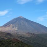
The data provided by Aemet also shows this winter has been the snowiest of the last nine years. According to their data, the Teide has accumulated 97 litres per square metre of precipitation as snow this winter. This is a high figure, but it does not reach the 162 litres per square metre accumulated in the winter of 2017-2018, let alone the 284 of the winter of 2004-2005. On the other hand, it has also been one of the years with the least sunshine due to the amount of cloud cover over the island skies.

Fuel spill prompts marine pollution alert in Gran Canaria

Tuesday: Strong winds and a calima haze

Monday: summer sun, strong winds, and calima aloft
Tenerife weather: stable Sunday with calima and strong winds

Sunday: Saharan dust and gusty trade winds

Saturday: calima and strong winds for the weekend
Tenerife volcanic traffic light not needed, says minister

Thursday: Heat and strong winds across the Islands

Wednesday: warmer weather across the Islands