Strong winds and coastal alerts continue
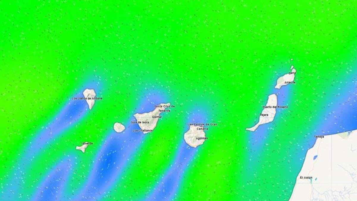
Wind and adverse coastal conditions have been affecting Tenerife all week, keeping yellow warnings from the State Meteorological Agency (Aemet) in place. This situation looks set to continue on Monday, with a new yellow warning activated for the island, as well as for El Hierro and Gran Canaria.
Monday’s warning details
The warning will be in effect from 18:00 hours, affecting the east, south and west coasts of Tenerife. Specifically, northeasterly winds of 50 to 61 km/h (force 7) are expected in the channel between Tenerife and Gran Canaria. Initially, the alert is expected to remain active until the early hours of the morning.
Forecast for Tenerife
Aemet’s weather forecast for Tenerife indicates predominantly cloudy skies in the north below 900 to 1,000 metres, with the possibility of occasional drizzle in the early hours in the mid-altitude areas of the northeast, clearing to brighter spells in the afternoon. Elsewhere, it will be mostly clear or sunny with intervals of high cloud and some cloud cover in the morning on the west coast. Temperatures will see little change, aside from slight rises in higher areas. Moderate trade winds will blow strongly on the southeast slopes and the far northwest, with occasional very strong gusts, especially in the afternoon. Light breezes are expected in the west, with light and variable winds in the central peaks.
General outlook for the Canary Islands
Across the archipelago, cloudy skies are expected in the north of the islands, with a low probability of occasional drizzle early in the day in the mid-altitude areas of the more mountainous islands. Elsewhere, skies will be mostly clear or sunny. Moderate trade winds will be strong on the southeast and northwest slopes of the mountainous islands, with occasional very strong gusts.
What’s happening in the Canaries – straight to your phone
News, weather alerts and practical updates – direct from the islands, in English. We live here and know what’s going on – before the international media catch up. Everything lands on our WhatsApp channel – no middlemen, no algorithm. Curated for families, expats and travelers.

Tuesday: sun, warmth, and calima returns

Heatwave alert: Gran Canaria faces high temperatures

Monday: calmer winds and patchy northern clouds

Tenerife science museum offers free glasses for August solar eclipse

Sunday: calmer winds and scattered clouds

Playa Jardín hit by new contamination just weeks after reopening
Friday: calima haze and strong gusts for the Islands

Thursday: strong winds, calima and 37°C on Gran Canaria
Canary Islands heatwave: Temperatures to hit 37°C