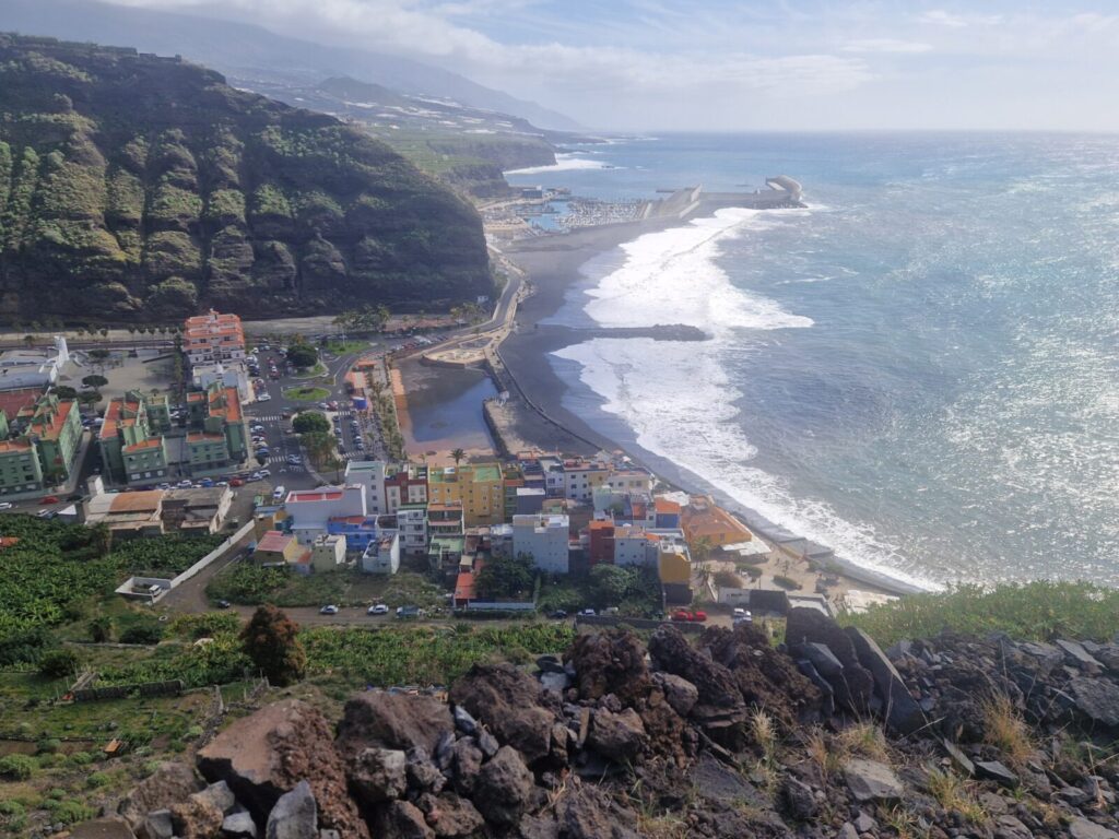
Rising abruptly from the Atlantic Ocean, La Palma is the steepest island on Earth relative to its surface area. Located in the western region of the Canary Islands, this UNESCO Biosphere Reserve reaches from sea level up to 2,426 meters over a landmass of 708 square kilometers. The terrain features deep ravines, pine ridges, and recent lava flows rather than manicured resort strips. For travellers seeking quiet trails, astronomical observation, and raw volcanic geography, it offers an authentic island experience. Conversely, those searching for extensive white-sand beaches, calm hotel enclaves, or commercial nightlife will find better fits elsewhere in the archipelago.
Known locally as La Isla Bonita, the island balances strict environmental conservation with practical visitor infrastructure. Over 35 percent of the surface area is legally protected, centered on the massive Caldera de Taburiente crater. Visitor traffic remains moderate compared to neighboring islands, leaving hiking networks and mountain miradores largely uncrowded throughout the year.
When to visit La Palma
Selecting the best time for a trip depends on your primary activities, as weather conditions vary significantly by elevation and season. The winter period from January through March brings coastal daytime temperatures averaging 20°C to 22°C, with night lows around 14°C to 16°C. While coastal zones remain mild, northern and eastern slopes receive periodic rain showers, and summit temperatures at Roque de los Muchachos regularly drop to 0°C with frost or light snowfall. Winter attracts European hikers seeking mild conditions, making accommodation bookings busier across major towns.
Spring from April through June offers stable hiking conditions with coastal temperatures rising to 24°C. Trade winds remain moderate, clear skies predominate on the western side, and wildflowers bloom across the high pine forests. Summer from July through September delivers daytime highs of 26°C to 29°C along the coast, with sheltered spots like Tazacorte frequently exceeding 30°C. Summer brings minimum cloud cover, making it the prime window for night stargazing tours and coastal swimming.
Autumn from October through December keeps ocean water warm at 22°C to 24°C, with daytime air temperatures around 25°C. Short-lived Saharan dust events (calima) occur two to four times per year, temporarily elevating temperatures by 5°C to 10°C and creating hazy horizons. Sea temperatures peak in October before tapering to their annual low of 19°C in February.
La Palma weather
The island functions as a miniature continent due to its steep central mountain ridge, creating pronounced microclimates between regions. Moisture-laden trade winds hit the northeastern slopes, generating a sea of clouds (mar de nubes) between 800 and 1,500 meters altitude. In contrast, the south and west enjoy rain-shadow protection, recording over 3,000 annual sunshine hours. Before travelling across the island, check the complete La Palma weather overview for current conditions. For regional details, review the weather in Los Llanos de Aridane for sunny west coast forecasts, or consult the Santa Cruz weather forecast for eastern coastal conditions.
Best beaches in La Palma
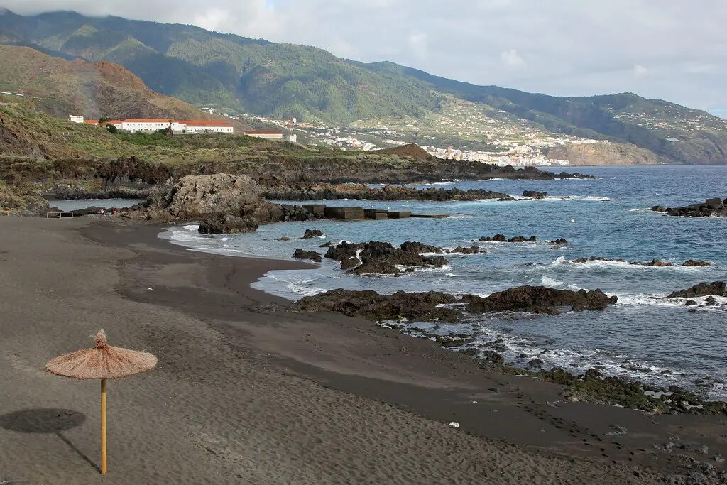
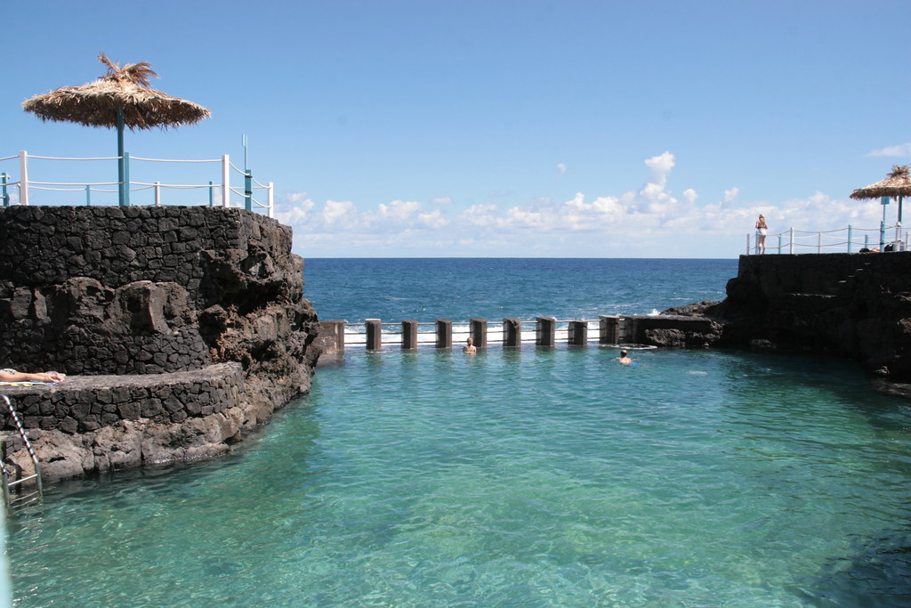
Coastal areas consist primarily of dark volcanic sand, steep basalt cliffs, and natural lava rock pools shaped by Atlantic waves. Safe swimming depends heavily on local geography and sheltered wave breakers. You can explore our guide to the best beaches in La Palma to compare facilities across the coastline. On the west coast, the wide black sands of Playa de Puerto Naos provide full resort services, while Playa de Tazacorte features a protective breakwater and boardwalk dining. On the eastern shore, Playa de Los Cancajos offers calm lava bays ideal for snorkeling. For natural sea baths, visit Charco Azul natural pools on the northeast coast, or trek down to the wild volcanic cove at Playa de Nogales where strong currents require extra swimming caution.
Things to do in La Palma
The Tajogaite volcano, formed during the 85-day eruption from September to December 2021 along the Cumbre Vieja ridge, represents one of the newest volcanic structures in Europe. As of July 2026, direct access to the Tajogaite crater remains strictly regulated. Visitors exploring the La Palma volcano area can join certified local guide groups for 5 to 6.5 km perimeter hikes costing €35 to €45 per person, starting from trailheads near Llano del Jable. Nearby in Puerto Naos, the black-sand beach, seafront promenade, SPAR supermarket, and local restaurants fully reopened in 2025 and 2026, backed by continuous real-time CO2 safety sensors across town.
For premier trail routes, Caldera de Taburiente National Park presents an 8 km wide erosion crater dropping 1,500 meters deep. Popular options for La Palma hiking include the flagship 12.8 km trek starting at Mirador de los Brecitos at 1,080 meters altitude, descending through pine slopes to the river area at Playa de Taburiente before following the Barranco de las Angustias gorge out to the car park. Shared 4×4 taxis from the bottom car park charge a fixed rate of €50 to €55 per vehicle (€8 to €15 per person) to reach the trailhead. For quick panoramic crater viewpoints without hiking, vehicle access to La Cumbrecita requires a free online parking permit between 08:30 and 16:00.
At the highest peak, Roque de los Muchachos rises to 2,426 meters, hosting international observatories including the 10.4-meter Gran Telescopio Canarias. The Visitor Centre at kilometer 37 on the LP-4 road features interactive astrophysics exhibits (€15 entry; open 10:00 to 17:00 in summer, 10:00 to 16:00 in winter). Daytime dome tours require advance online bookings. Protected under the 1988 Sky Law (Ley del Cielo) and recognized as a UNESCO Starlight Reserve, night stargazing tours (€50 to €60 per adult) operate from mid-altitude miradores like Llano del Jable with professional telescopes.
In the northeast, Bosque de Los Tilos preserves an ancient subtropical evergreen laurel forest. The 12.5 km Marcos y Cordero trail takes hikers through 13 narrow water tunnels to mountain springs from Casa del Monte (4×4 shuttle taxi €15 to €20 per person). Tunnel 12 extends 350 meters with internal water cascades, requiring a headlamp, waterproof jacket, and helmet. Finally, the capital of Santa Cruz features 17th-century pine balconies (pino tea) along Avenida Marítima, Plaza de España, Calle O’Daly (named after Irish merchant Dionisio O’Daly who led Spain’s first democratically elected city council in 1773), and the Barco de la Virgen naval museum built inside a concrete replica of Columbus’s caravel.
Getting there and around
Santa Cruz Airport (SPC) sits in Mazo, 8 km south of the capital. Inter-island flights operated by Binter Canarias and Canaryfly connect from Tenerife North, Tenerife South, and Gran Canaria in 30 to 40 minutes, with non-resident one-way fares starting from €30 to €50. Direct flights also connect from European hubs including London Gatwick, Manchester, Madrid, Frankfurt, and Amsterdam. Maritime connections depart from Los Cristianos in southern Tenerife to the Port of Santa Cruz. Fred. Olsen Express operates fast catamarans taking 2 hours 30 minutes (€40 to €60 one-way), while Naviera Armas runs standard ferries taking 3 hours to 3 hours 30 minutes (€30 to €50 one-way), which is ideal for transporting rental vehicles.
Public bus services run by TILP (Transportes Insular) serve coastal settlements reliably. Line 500 connects the airport to Santa Cruz and Los Cancajos every 30 minutes (€2.40), Line 300 links Santa Cruz to Los Llanos de Aridane via the LP-3 tunnel (€2.60), Line 200 handles the southern loop, and Line 100 covers the northeast coast. Single fares range from €1.50 to €2.60 payable by cash or contactless card. However, public buses do not service major mountain trailheads such as Roque de los Muchachos, Los Brecitos, or Casa del Monte. Hiring a rental car through island operators like Cicar or Autoreisen (which include full insurance without excess) is essential for accessing hiking zones when visiting the La Palma Canary Islands region. Note that driving involves steep gradients, tight hairpin turns, and passing through the LP-3 tunnel, which frequently transitions from eastern cloud to western sunshine within minutes.
Island news, updated daily
Staying informed about local updates is essential when planning mountain hikes or coastal excursions across the island. Our editorial team monitors road maintenance notices on the LP-4 summit route, trail status reports in national parks, weather shifts, and ferry schedule adjustments in real time. Follow our dedicated La Palma news section for daily reports on island developments, environmental updates, and practical travel advisories straight from local residents.
Yes, for outdoor enthusiasts, hikers, and stargazers seeking dramatic volcanic landscapes and uncrowded nature rather than commercial nightlife. Known as La Isla Bonita, the island offers UNESCO Biosphere status, 2,400-meter peaks, and dark-sky reserves. It is less suitable for travellers looking for white sand beaches or loud clubs. Practical tip: Stay on the west side around Los Llanos for the most sunshine hours.
Yes, but accessing the crater rim of the Tajogaite volcano requires a certified local guide. Circular guided hiking tours cover 5 to 6.5 km along designated perimeter trails for €35 to €45 per person. In nearby Puerto Naos, black-sand beaches and restaurants fully reopened in 2025 and 2026, monitored by real-time air quality sensors. Practical tip: Reserve guided crater tours several weeks in advance as daily visitor slots are strictly limited.
5 to 7 days is the ideal timeframe to experience primary island sights without rushing. This duration allows for the 12.8 km Caldera de Taburiente hike, visiting Roque de los Muchachos Observatory, exploring Los Tilos forest, and spending a day in historic Santa Cruz. A shorter 3-day trip forces you to skip major hiking regions. Practical tip: Split your stay between the east coast and west coast to minimize driving on winding mountain roads.
Yes, hiring a car is strongly recommended if you plan to hike or explore mountain viewpoints. Public TILP buses reliably connect coastal towns like Santa Cruz and Los Llanos for €1.50 to €2.60, but they do not serve natural trailheads like Roque de los Muchachos, Los Brecitos, or Casa del Monte. Practical tip: Choose local Canary Island rental companies like Cicar or Autoreisen for zero-excess insurance and simple booking.
No, if you expect long stretches of golden sand, but yes if you enjoy volcanic black-sand coves and natural ocean pools. Places like Playa de Puerto Naos, Playa de Los Cancajos, and Charco Azul offer clean swimming waters with lifeguard services. However, strong Atlantic currents mean wilder spots like Playa de Nogales require extra caution. Practical tip: Always check green and red flag warnings before entering the water at un-sheltered Atlantic beaches.
Latest from La Palma

The Canary Islands on WhatsApp – get the news faster than ever
Why adults only hotels are booming in the Canary Islands

Sunday: calmer winds and scattered clouds

Why Canary Islands hotels stick to 3pm check-in

Canary Islands to get first dedicated biodiversity law

India’s youth protests: a generation fights back

Canary Islands affordable housing applications surge to 4,047

Canary Islands wages second lowest in Spain despite tourism boom

Friday: calima haze and strong gusts for the Islands