La Gomera is the second-smallest of the inhabited Canary Islands, defined by 600 kilometers of signposted hiking routes, deep basalt ravines, and ancient cloud forest. Located just 15 nautical miles off the southwestern coast of Tenerife, the island offers an alternative to high-density resort tourism. There are no mega-resorts, no themed water parks, and no sprawling golden sand beaches here. Instead, steep volcanic mountains rise sharply from the Atlantic to a central high plateau at Alto de Garajonay, reaching 1,487 meters.
If you want fast-paced nightlife or commercial beach clubs, skip La Gomera and stay on Tenerife. This destination suits independent travellers, walkers, and nature enthusiasts looking for quiet coastal valleys, traditional mountain villages, and ancient ecosystems like Garajonay National Park. Navigating the terrain requires handling winding mountain roads and significant elevation changes, but the reward is an authentic island environment shaped by centuries of terracing and distinct island traditions.
Best time to visit La Gomera
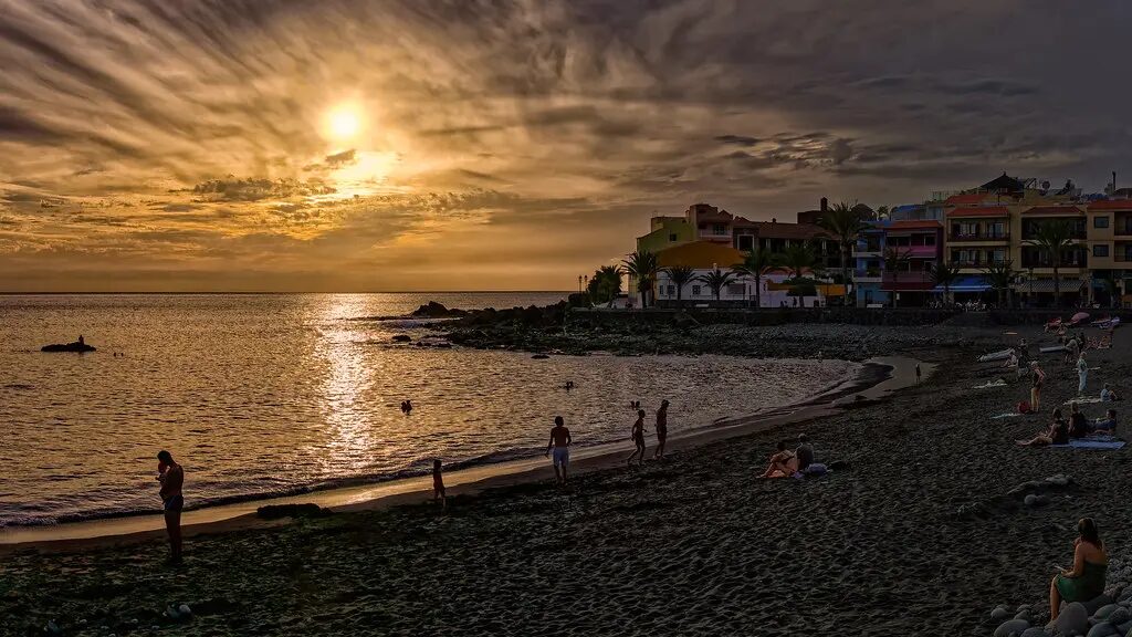
The island experiences a perpetual spring climate, but distinct microclimates mean weather conditions vary dramatically depending on location and elevation. The southern and western coasts around Valle Gran Rey and Playa Santiago remain warm and dry, averaging up to 360 sunny days annually. Conversely, northern valleys such as Hermigua and Agulo receive moisture-laden trade winds (alisios) that keep landscapes green while bringing frequent cloud cover and cooler temperatures.
Winter (January to March) brings daytime coastal temperatures between 22°C and 24°C, dropping to 17°C at night. Sea temperatures drop to their annual low of 19°C. Higher elevations in the central plateau regularly see temperatures between 10°C and 14°C accompanied by dense fog, requiring warm layers and windproof gear for hiking. This period marks the peak season for European walking tourists, driving up accommodation demand in main towns.
Spring (April to June) and autumn (October to December) deliver optimal hiking conditions across the archipelago. Daytime temperatures average 23°C to 25°C with minimal rainfall and moderate humidity. Summer (July to September) brings coastal peak temperatures of 27°C to 28°C and water temperatures of 24°C to 25°C. Summer brings occasional calima events (Sahara dust storms) that push inland temperatures above 30°C and lower mountain visibility. Tourism peaks again in July and August due to domestic inter-island travel from mainland Spain and Tenerife.
La Gomera weather
Understanding regional microclimates is essential when planning daily itineraries. Coastal areas remain sunny and warm year-round, while mountain summits frequently sit inside a sea of clouds (mar de nubes). For detailed monthly temperature averages, wind forecasts, and historical rainfall stats, consult our island weather overview. If your base is the eastern port city, check the forecast for our San Sebastian weather breakdown. Travellers staying on the sheltered western coast can track local conditions via our dedicated Valle Gran Rey forecast.
Best beaches in La Gomera
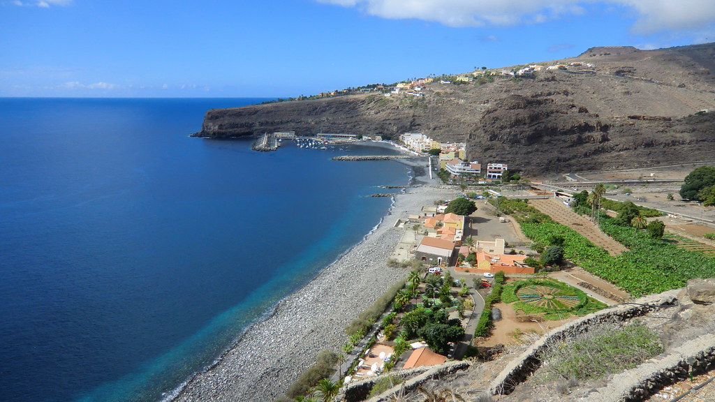
The shoreline consists mainly of dark volcanic sand, smooth gray pebbles, and steep cliff drops into the Atlantic Ocean. Swimming conditions vary by region; northern and western shores face strong swells, while southern bays offer sheltered waters. Read our comprehensive best beaches guide to locate safe swimming zones. On the quiet southern coast, explore the pebble cove and sun-warmed shore at Playa de Santiago. For western sunsets and broad volcanic stretches, review details on visiting Playa de Valle Gran Rey.
Things to do in La Gomera
Exploring the terrain centers on outdoor activity, cultural heritage, and natural geological landmarks. Visitor pursuits focus on ancient forests, mountain villages, and coastal cliffs.
Garajonay National Park: Covering 3,984 hectares across the central high plateau, Garajonay National Park was designated a UNESCO World Heritage Site in 1986. It preserves laurisilva (subtropical laurel forest), a living fossil ecosystem that covered the Mediterranean basin millions of years ago before ice ages wiped it out on the European mainland. Moisture from trade winds condenses on leaves – a process called horizontal precipitation (lluvia horizontal) – sustaining dense fern groves, moss-draped laurel trees, and endemic species such as Bolle’s and Laurel pigeons. Route 7 leads from Contadero parking to Alto de Garajonay (1,487 m), a 2.5-kilometer round-trip walk with 100 meters of elevation gain leading to ceremonial stone structures (losas de culto). To understand park geology and endemic fauna, visit the Juego de Bolas Visitor Centre in Agulo (open daily 09:30-16:30, free admission).
Valle Gran Rey & Western Valleys: Located on the western coast, Valle Gran Rey features terraced hillsides planted with date palms and banana crops. Key beaches include Playa de La Calera for calm swimming, Playa de Vueltas near the fishing port inside the breakwater, and Playa del Inglés, an unshaded black sand beach below cliffs known for clothing-optional swimming and strong rip currents. Each evening, locals and travellers gather at Playa del Inglés for spontaneous sunset acoustic drumming sessions.
Agulo, Hermigua & Mirador de Abrante: In the north, Agulo is recognized as one of Spain’s prettiest villages, set on a natural red-rock terrace facing Mount Teide across the sea. Nearby, the Mirador de Abrante skywalk features a 7-meter glass cantilever platform extending over a 200-meter sheer cliff drop (open daily 11:00-19:00, free admission). In neighboring Hermigua, deep agricultural valleys house the twin volcanic plugs Roques de Pedro y Petra and the Pescante de Hermigua, the concrete ruins of an early 20th-century banana-loading pier.
Silbo Gomero Whistling Language: Inscribed on the UNESCO Intangible Cultural Heritage list in 2009, Silbo Gomero is an articulated whistling language developed by indigenous islanders to transmit phonemes across deep ravines (barrancos) up to 5 kilometers away. Taught as a mandatory school subject since 1999, visitors can experience authentic live demonstrations at local establishments such as Restaurante Las Rosas in Agulo and the Parador de San Sebastian in San Sebastian.
Hiking Routes & Basalt Cliffs: Over 600 kilometers of signposted paths cover the island. Multi-day options include the GR 131 (a 41 to 45 kilometer ridge trail from San Sebastian to Vallehermoso) and the GR 132 (a 120 to 130 kilometer coastal perimeter loop). Popular day walks include the 5-kilometer circular loop around Roque de Agando (1,251 m). On the remote northern coast of Vallehermoso, Los Órganos presents an 80-meter high cliff of exposed vertical basalt columns formed by cooling volcanic lava, accessible exclusively by boat excursions from Valle Gran Rey or San Sebastian when sea conditions allow.
Columbus History in San Sebastian: Known as La Isla Colombina, San Sebastian served as Christopher Columbus’s final departure port in August 1492. Historical landmarks include the Torre del Conde, a 15-meter square stone tower built in 1447 as the oldest surviving post-conquest military structure in the Canaries, and the Casa de la Aguada, containing the historic well used to supply drinking water for his fleet before crossing the Atlantic.
Getting there and around
Reaching the island relies on high-speed maritime crossings and regional inter-island flights.
Ferry Connections: Booking a ferry to la gomera from Los Cristianos in Tenerife South to San Sebastian is the primary access method. Two main ferry operators serve the route: Fred. Olsen Express (operating high-speed catamarans like Benchijigua Express) and Naviera Armas (operating vessels like Volcan de Tirajana). The crossing takes 50 minutes, with 6 to 8 daily departures between 08:45 and 21:30. As of July 2026, standard adult non-resident foot-passenger fares cost between €43 and €47 one-way. Transporting a car costs an extra €30 to €50. Early booking is essential during peak winter months.
Flight Logistics: the local airport (GMZ) sits in the southern municipality of Alajeró on Lomada de Tecina near Playa Santiago. Regional airline Binter Canarias operates turboprop aircraft (ATR 72) with direct connections to Tenerife North (TFN, 2 daily flights, 30-minute flight time) and Gran Canaria (LPA, 2 daily flights, 50-minute flight time). Direct flights do not operate from Tenerife South, making ferries more convenient for travellers arriving at TFS.
Public Buses vs. Car Rental: Public transit operator GuaguaGomera runs 8 main bus routes across the island, with fares ranging from €2 to €5 paid in cash to the driver. Key routes include Line 1 (San Sebastian to Valle Gran Rey, ~€5, 90 minutes), Line 3 (San Sebastian to Alajeró/Airport, ~€4), and Line 6 (Valle Gran Rey to Airport, ~€5). Bus departure frequencies remain limited to 3 to 5 trips daily per line. Hiring a rental car from agencies at San Sebastian port or the airport (such as CICAR or Auto Reisen) is strongly recommended for accessing trailheads along main mountain highways like GM-1 and GM-2. Mountain driving speeds average 40 to 50 km/h due to sharp switchbacks, steep gradients, and localized summit fog.
Island news, updated daily
Our resident editorial team monitors local infrastructure and travel developments across the region every day. We report on maritime ferry schedule changes, public bus updates, mountain weather advisories, national park trail maintenance, and island cultural events. Stay updated on current conditions by visiting our island news page.
Yes, if your trip focuses on outdoor hiking, ancient forest trails, and quiet mountain villages rather than nightlife or sandy beach resorts. The island features 600 kilometers of marked trails, including Garajonay National Park and dramatic basalt ravines. It remains one of the quietest islands in the Canaries, ideal for nature lovers seeking a slow pace. Pack sturdy hiking boots and weather layers for elevation changes.
50-minute ferry crossings from Los Cristianos port in Tenerife South to San Sebastian provide the easiest access. Operators Fred. Olsen Express and Naviera Armas run 6 to 8 daily sailings combined, with adult passenger fares starting around €43 one-way as of July 2026. Alternatively, regional airline Binter Canarias operates daily flights from Tenerife North and Gran Canaria to the local airport in Alajeró. Book ferry tickets online in advance if travelling with a rental vehicle.
Yes, day trips from Tenerife South are feasible thanks to early 08:45 ferry departures and late returns around 20:30 from San Sebastian. A single day allows enough time to visit the central laurel forest in Garajonay National Park, view the Mirador de Abrante skywalk, and stop for lunch in Agulo or Valle Gran Rey. However, driving across mountain switchbacks takes time. Focus on one specific region like Garajonay rather than attempting to loop the entire island in a single day.
Yes, renting a vehicle is highly recommended if you plan to explore remote trailheads, northern miradors, and coastal valleys efficiently. GuaguaGomera public buses serve main towns on lines 1 through 8 for €2 to €5 per trip, but frequencies are low with only 3 to 5 departures daily. Rental agencies like CICAR operate directly at the San Sebastian ferry terminal and airport. Be prepared for steep switchbacks and average driving speeds of 40 to 50 km/h.
4 to 5 days allow enough time to explore the major hiking routes, mountain villages, and coastal valleys without rushing. A stay of this length permits walking key trail segments in Garajonay National Park, visiting Agulo and Hermigua, relaxing in Valle Gran Rey, and attending a traditional Silbo Gomero whistling demonstration. Dedicated long-distance trekkers tackling the GR 131 or GR 132 routes should allocate 7 to 10 days. Base yourself in Valle Gran Rey for sunny coastal weather near trail access points.
Latest from La Gomera

The Canary Islands on WhatsApp – get the news faster than ever
Why adults only hotels are booming in the Canary Islands

Sunday: calmer winds and scattered clouds

Why Canary Islands hotels stick to 3pm check-in

Canary Islands to get first dedicated biodiversity law

India’s youth protests: a generation fights back

Canary Islands affordable housing applications surge to 4,047

Canary Islands wages second lowest in Spain despite tourism boom

Friday: calima haze and strong gusts for the Islands