
Compiled with the help of artificial intelligence, based on Spanish-language information. Source below the article.
A new archaeological survey at the Risco Caído cave complex in Gran Canaria could unlock fresh details about how this dramatic landscape was shaped and settled over the centuries, according to island heritage officials.
Ceramics and charcoal recovered
The survey, funded and promoted by the Cabildo de Gran Canaria, has recovered fragments of historic ceramics originating from Lugarejos, along with several samples of charcoal. These new materials will help to refine our understanding of how this enclave, part of the UNESCO-listed Cultural Landscape of Risco Caído and the Sacred Mountains of Gran Canaria, evolved over time.
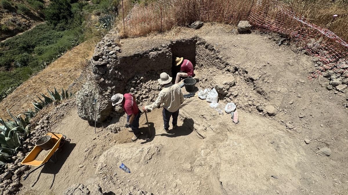
The fieldwork took place in the cave front at Risco Caído, in the Barranco Hondo area, straddling the municipalities of Artenara and Gáldar. The dig was organised through the island’s Insular Institute for the Integrated Management of World Heritage and the Biosphere Reserve, and came about after archaeological remains were accidentally uncovered during works to improve, beautify and enhance the Site of Cultural Interest (BIC). The discovery made a dedicated survey essential, both to document and recover the finds and to ensure their conservation, while also expanding the available knowledge about the historical occupation of the site.
Clues in the terraces
Fieldwork was carried out by the company Arqueocanaria S.L., which located the pottery fragments and charcoal samples mainly in the agricultural terraces, or bancales, and at other points within the site itself. Beyond the recovered items, the survey offers fresh evidence about the relationship between the agricultural structures and the cave complex. The results reinforce the theory that the terraces were built using materials extracted during the excavation and creation of the artificial caves.
This potential reuse of materials shows how human activity progressively reshaped the surroundings, making the most of resources generated by the very transformation of the landscape. The terraces, therefore, may preserve part of the physical footprint left by the different periods of occupation at Risco Caído.
Laboratory analysis under way
With the field phase now complete, the archaeological work has entered a second stage. The recovered materials will be analysed in the laboratory by researchers from the University of Las Palmas de Gran Canaria (ULPGC), under the collaboration agreement the university maintains with the Institute for World Heritage and the Biosphere Reserve. Analysis of the ceramics, charcoal and other evidence will provide new data on their chronology and origin, helping to reconstruct more precisely the beginnings and evolution of human settlement in this territory.
The results should also shed light on how the relationship between the caves, the cultivation areas, and the different ways of using the land was organised over time.
Protecting a living cultural landscape
The project forms part of the work programme of the Insular Institute for the Integrated Management of World Heritage and the Biosphere Reserve of Gran Canaria, which focuses on conserving, protecting, researching, managing and promoting the cultural and natural values of these internationally recognised UNESCO territories. In the case of Risco Caído, archaeological research not only broadens scientific knowledge of the site, but also provides new tools to guide its conservation and management as part of a cultural landscape whose value lies precisely in the long interaction between human communities and the land.
What’s happening in the Canaries – straight to your phone
News, weather alerts and practical updates – direct from the islands, in English. We live here and know what’s going on – before the international media catch up. Everything lands on our WhatsApp channel – no middlemen, no algorithm. Curated for families, expats and travelers.

Canary Islands sea hits second-hottest year on record

Legal bid to halt tree felling in Santa Cruz’s La Salud

Fiesta del Charco: A journey through La Aldea’s past

Corralejo dunes power line set for removal

ULPGC launches 14 research projects at Las Canteras

TMT will never be built, says Canary Islands astrophysics chief

Pedro Duque: Canarias is the “ultimate dream” for rockets

Court blow to Tenerife motor circuit project
La Palma faces new volcanic risk planning deadline
