Storm System to Bring Rain and High Winds
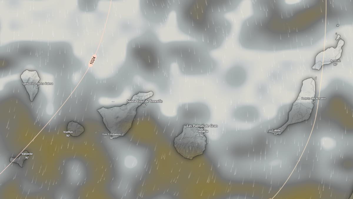
The Canary Islands are bracing for a major shift in the weather with the arrival of a deep low-pressure system. From Thursday, it is forecast to bring rain to the northern parts of the islands, very strong wind gusts, and dangerously rough sea conditions, according to the State Meteorological Agency (Aemet).
Aemet spokesperson, Rubén del Campo, explained that this low will circulate to the west of the Iberian Peninsula between Wednesday and Thursday before heading towards the archipelago. “It will cause an increase in instability,” he stated, specifying that in the Canaries it will bring “precipitation in the north, with very strong wind gusts and poor sea conditions across the archipelago, especially on Thursday.”
Detailed Forecast: From Rain to a Dramatic Cooldown
For Wednesday, the forecast already points to rain in the north of the islands and a drop in temperatures across the archipelago. Thursday will see more adverse conditions as the low-pressure system moves closer, bringing a clear deterioration in the state of the sea, where waves of over five metres are expected, alongside intense winds.
Unsettled weather will continue on Friday, with rain in the north of the more mountainous islands and the possibility of some light precipitation elsewhere. Temperatures are not expected to change much that day.
However, the most marked change is likely to arrive during the weekend. Del Campo warned that “the weekend could be rainy due to the passage of a weather front” and indicated that, after this front, “cold air will arrive.” This will mean a shift from having “very high temperatures for the time of year on Thursday and Friday” to “a very cold, practically wintry day on Sunday and, to a lesser extent, at the start of next week.”
From Summer to Winter in Days
Although Aemet detailed the strong thermal contrast mainly for mainland Spain, the agency framed this episode within a situation of great atmospheric variability. In fact, it summarised this scenario on social media with a very graphic phrase: “From summer to winter.” It added: “In spring it is normal for the temperature to vary sharply from one day to the next. But this weekend the temperature drop will be extraordinary.”
Saturday will be marked by the passage of a front and a major weather change, with precipitation affecting much of the country and a notable drop in temperatures following the arrival of a mass of cold air. In the case of the Canary Islands, this unstable weekend scenario could also translate into further rain. On Sunday, according to Del Campo, the coldest air of the episode will arrive, creating a “practically wintry” situation. Aemet thus underscores the magnitude of a very abrupt atmospheric change in just a few days, right at the start of April.
Tenerife weather: stable Sunday with calima and strong winds

Sunday: Saharan dust and gusty trade winds

Saturday: calima and strong winds for the weekend
Tenerife volcanic traffic light not needed, says minister

Thursday: Heat and strong winds across the Islands

Wednesday: warmer weather across the Islands

Tuesday: stable weather and rising temperatures

Monday: stable skies and a flat Atlantic

Tenerife weather: Cloudy intervals and 28°C highs for Sunday