New strategy takes aim at car dependency in Anaga Rural Park
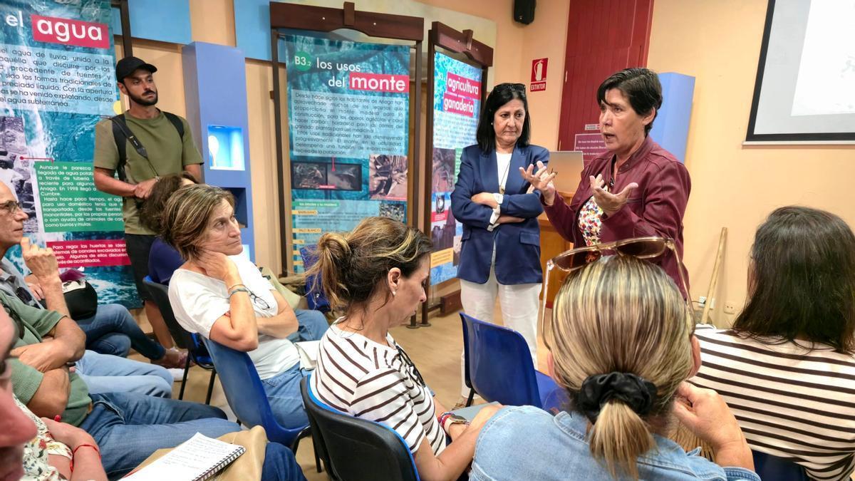
The Visitor Centre at the Cruz del Carmen viewpoint played host on Monday to the launch of the Anaga Biosphere Reserve’s sustainable mobility strategy. The document, drawn up from 1,411 surveys carried out among residents and visitors between 1 November and 11 December 2024, was endorsed by the CajaCanarias Chair of Economics and Mobility at the University of La Laguna, under the direction of Rosa Marina González Marrero, and financed by Next Generation funds. The conclusions were developed by Colin Buchanan Consultores.
With an investment of €5,096,995, the new mobility strategy — a living document still in draft form — is betting on a model that relies less on private cars and more on public transport, combined with intelligent management of access points. The initiative brings together 24 separate actions designed to tackle the root causes of the problem, rather than merely treating its symptoms.
No new roads: focus shifts to alternatives
The approach explicitly rules out widening roads or opening new access routes, acknowledging the constraints imposed by a protected territory with a road network of limited capacity. The solution, officials say, lies in offering alternatives to the private vehicle, managing visitor arrivals, and better distributing movements across a finite space where increased traffic directly impacts both safety and environmental conservation.
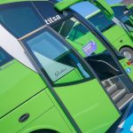
The bulk of the proposed actions centre on public transport. The plan envisages a network of shuttle buses linking park-and-ride facilities with Cruz del Carmen, the main viewpoints, and access points to the most popular hiking trails. The aim is to reduce the number of vehicles reaching high-demand areas simultaneously and to encourage most visitors to complete their journey by collective transport. This system will be complemented by improvements to the regular Titsa bus service. The study recommends increasing frequencies, adjusting timetables, and reviewing certain routes so that the bus ceases to be a secondary option and can meet both residents’ needs and tourist demand. Without more competitive public transport, it will be difficult to reduce dependence on private cars, the study concludes.
On-demand transport for remote hamlets
Among the new features is the introduction of on-demand transport for the most scattered settlements, with pilot schemes allowing routes and timetables to be adapted to real user needs before the system is rolled out across the entire massif. The aim is to improve connections for small hamlets without increasing road traffic. The Cabildo (island government) also plans to implement a pre-booking system, supported by sensors and traffic counters capable of measuring road and car park occupancy in real time. This information will make it possible to anticipate congestion and regulate access when the territory’s capacity approaches its limit.
Parking clampdown and coach restrictions
Parking regulation forms another pillar of the plan. Actions include stricter control of vehicles parked on roadside verges, specific management of campervans, and optimisation of designated parking areas. The aim is to prevent the search for a space, or illegal parking, from continuing to reduce road capacity and impede the passage of buses, residents, and emergency vehicles. The strategy also recommends restricting access for tourist coaches whose length makes them difficult to manoeuvre on the narrowest sections of road, causing tailbacks that end up affecting the entire road network. The measure is not intended to reduce visitor numbers, but to adapt the type of transport to the characteristics of a territory with no capacity to absorb more traffic.
Better enforcement and safer roads
The document proposes strengthening road safety through a greater presence of the Civil Guard, the Canary Islands Police, local police forces, and environmental officers; better lighting at strategic points; stricter enforcement against illegal parking; and measures to facilitate coexistence between private vehicles, buses, cyclists, and pedestrians. The plan also envisages improving the network of viewpoints, regulating access to hiking trails, creating new pedestrian and cycling routes, providing better visitor information through multi-language campaigns, and promoting lesser-known areas to distribute visitor numbers more evenly and prevent pressure from concentrating on the same sites.
Resident involvement crucial, says councillor
All of this is to be done with resident participation in mind — hence the description of the document as a “living” document, explains Blanca Pérez, the Cabildo’s Councillor for Natural Environment. She acknowledges that the bulk of the work on the strategy has fallen to the Mobility department headed by Eulalia García, although it is Pérez who is leading dialogue with local residents’ representatives.
The study identifies a clear pattern: the private car is the main means of transport because public provision does not meet the population’s needs. Nearly 74 per cent of those surveyed regularly have access to a car, and more than half use it as their main means of getting around Anaga. The diagnosis also confirms the scale of traffic problems. Eight out of ten respondents say they regularly encounter congestion at the entrances to viewpoints and main points of interest, while more than 70 per cent report difficulty finding parking. Added to this are vehicles parked on roadside verges, complications caused by coaches trying to pass each other, and tailbacks resulting from cyclists sharing narrow roads.
Widespread public support for regulation — with conditions
The survey also reveals broad public support for regulatory measures, provided they are accompanied by effective alternatives. Three out of four participants consider it necessary to limit access when the territory’s capacity is exceeded, and a majority say they would be willing to use alternative transport systems if these offered a sufficient service. This alignment between the technical diagnosis and public perception explains the emphasis the strategy places on strengthening public transport and managing access.
Councillors defend coordinated approach
Councillor Blanca Pérez maintains that the Cabildo’s priority is to preserve the Biosphere Reserve by reducing the pressure exerted by private vehicles on a fragile environment. She explains that the 24 actions form part of a coordinated plan with the Mobility and Highways departments, backed by investments aimed at regulating public use of trails, improving the network of viewpoints, and creating pedestrian and cycling routes compatible with both local activity and environmental conservation. Pérez highlights the coordinated work of the Civil Guard, Canary Islands Police, local police forces, and environmental officers to reinforce safety and minimise the effects of the constant increase in visitors. In her view, mobility and the protection of the natural environment must be addressed together to guarantee the Reserve’s future.
Councillor for Mobility, Eulalia García, describes the strategy as a change in the way access to the massif is managed. She explains that the booking system, sensors, and traffic counters will make it possible to know real-time occupancy levels on the roads and to act before saturation occurs. This regulation will be supported by shuttle buses, park-and-ride facilities, and on-demand transport for the most isolated settlements. The aim, she sums up, is to reconcile residents’ needs with the conservation of the territory.
Residents voice reservations over presentation
The document has been received with reservations by some of those who attended the information meeting organised by the Cabildo. Toño Hernández, a resident of Taborno, admits he was overwhelmed by the documentation provided — the mobility strategy runs to more than 170 pages — and prefers to analyse it in detail before giving his assessment of the content presented on Monday. Marina Suárez, a resident of Casas de la Cumbre, believes the meeting “offered no significant new information” and argues that the plan “still contains major gaps,” lacking a sufficiently defined strategy to explain how the mobility problems will be resolved. Suárez regrets that the meeting did not provide concrete answers to the questions raised by residents’ groups, and notes that a further meeting had to be called because the document had not been sent out in advance for review. In her view, this creates the impression of meetings being held “without meaningful progress or concrete decisions.”
The resident also questions some of the proposed parking solutions. She considers it difficult to create new spaces through green or blue zone schemes in hamlets where hardly any land is available for that purpose. In her opinion, the fundamental decisions are still awaiting “clear, realistic, and consensual” planning.
University diagnosis: manage, don’t build
Between the institutional vision and residents’ demands, the strategy rests on the diagnosis from the University of La Laguna: mobility in Anaga is not about building more roads, but about better managing access, strengthening public transport, and distributing tourist pressure differently. The 24 actions proposed by the Cabildo represent the first attempt to manage this mobility from a joint perspective. Their implementation will test whether it is possible to reconcile the conservation of a Biosphere Reserve, tourist activity, and the quality of life of those who live in the massif.
What’s happening in the Canaries – straight to your phone
News, weather alerts and practical updates – direct from the islands, in English. We live here and know what’s going on – before the international media catch up. Everything lands on our WhatsApp channel – no middlemen, no algorithm. Curated for families, expats and travelers.

Work on TF-5 third lane between Guamasa and Los Rodeos to start in November
Canary Islands international air arrivals fall 1.3% in September

Helicopter evacuates US cruise passenger near Tenerife
El Hierro airport sees 3.6% rise in September passengers
Gran Canaria approves €509k works to shore up GC-200 slope
Canary Islands gets €47.5m for free public transport in 2026
Canary Islands airports see 0.9% fall in September passengers
El Rejo road in La Gomera to close for six hours on Tuesday
Man, 65, seriously injured in GC-1 crash in Agüimes