
Compiled with the help of artificial intelligence, based on Spanish-language information. Source below the article.
Santa Cruz ravines top flood damage list
The Almeyda and Tahodio ravines in Santa Cruz are the two biggest flood black spots in Tenerife. Between 1996 and 2024, these two channels accumulated more than €117 million in insurance compensation for damage and claims – 63% of all the money paid out for extreme flood risk episodes identified across the island. In other words, two out of every three euros compensated.
The figure, drawn from data supplied by the Insurance Compensation Consortium, forms part of an analysis carried out by the Tenerife Island Water Council (Ciatf) to identify the most vulnerable areas over the next six years.
Almeyda: the most damage-prone channel
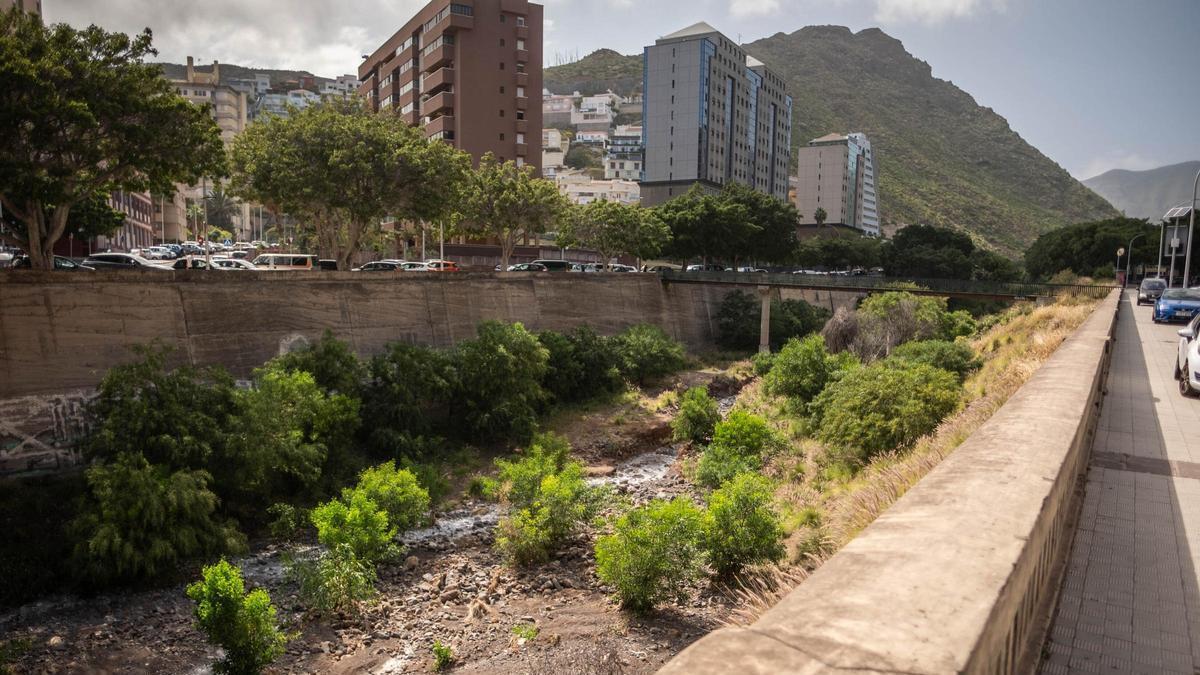
The Almeyda ravine is the most significant case. With €60 million in payouts, it is the channel that has accumulated the most damage of all those analysed in Tenerife. Its route, more than three kilometres long, cuts through the urban fabric of Santa Cruz, north of the centre and around El Toscal, passing beside the historic Fuerte de Almeyda before reaching the coast at Avenida de Anaga.
This is a channel profoundly shaped by the city – its final stretch is channelled underground and residential buildings and commercial premises have been constructed on the ravine land itself, a circumstance that makes it especially dangerous in the event of a flash flood. This combination of factors – the history of claims and the occupation of the ravine – has led Ciatf to include it among the 19 new risk channels on the map for the third planning cycle. Almeyda thus joins the points that will require priority monitoring for future flooding, given its high potential to damage structures and the danger of directly exposed populations.
Tahodio: high payouts but lower risk
The Tahodio ravine, meanwhile, rises in the mid-altitude zones of Anaga, around Hoya de las Palomas and near Cruz del Carmen, descending through a rural valley to the coast beside the La Alegría neighbourhood. Along its course lies the Tahodio Dam, a historic hydraulic infrastructure built at the beginning of the 20th century.
Its channel thus runs from a natural, rural environment into a densely urbanised area of Santa Cruz, but the new cycle’s analysis ultimately does not consider it a fluvial risk area. Although Tahodio accumulates nearly €58 million in Insurance Compensation Consortium payouts – a figure very similar to Almeyda’s – its hydraulic hazard indicators are much lower. This is because flooding here does not come from the ravine overflowing but from water accumulating in the streets due to the inadequate capacity of the urban drainage system. For this reason, Ciatf leaves it out of the 27 fluvial areas selected for monitoring, despite the high volume of damage recorded in its surroundings.
The capital bears 75% of the island’s costs
The weight of these two ravines helps explain the enormous concentration of damage borne by Santa Cruz de Tenerife, which accounts for 75% of all flood-related compensation across the island. The capital also contains other stretches with a significant historical bill. The Santos ravine adds more than €18 million in payouts, while its extension towards La Laguna, in the Santos-La Carnicería stretch, adds another €3 million. These are joined by the Hierro ravine with €11 million and the Muerto ravine, located in the metropolitan area, with nearly €7 million.
South Tenerife hotspots
Outside the capital, economic risk is spread across various points of the island, although with figures far lower than those of Santa Cruz. In the south, some of the most notable cases appear in Arona, where the Aquilino and La Carnada ravines each exceed €2 million in compensation payouts. La Carnada also stands out for the extent of surface area in the highest risk levels, while in the neighbouring municipality of Adeje, the Torviscas ravine accumulates nearly €2 million in damage.
A history of extreme weather events
All these points, especially exposed during episodes of intense rainfall and storms increasingly influenced by the effects of climate change, form part of the analysis aimed at anticipating future flooding. And recent history offers several examples. In February 2018, rainfall dumped more than 60 litres per square metre in some areas, causing flooding in La Orotava, Granadilla de Abona, La Laguna, Puerto de la Cruz and Arona.
Just eight months later, in October, another episode of intense rainfall caused flooding in ground-floor premises, problems with sewerage networks, supply cuts and landslides, as well as the rescue of four people in the Camino del Hierro ravine. The incidents spread across eight municipalities, including Santa Cruz, La Laguna, Güímar, Tegueste and Guía de Isora.
The succession of episodes continued in subsequent years. Santa Cruz and La Laguna recorded new flash floods in December 2020; Arona suffered flooding, mudslides and vehicles being swept away in January 2022; and a DANA – a cut-off low-pressure system – again caused numerous incidents in December of that year in municipalities such as Adeje, Güímar, Tacoronte, Puerto de la Cruz and Arico. In 2023 and 2024, problems recurred due to heavy rain and rough seas, with flooding, landslides, water pumping operations and damage to homes and roads in various parts of the island.
More recently, in November 2025, Storm Claudia left flooding and landslides, particularly in the southwest and the Isla Baja area. And in March 2026, Storm Therese caused ravines to swell and flooding, leading the Canary Islands Government to declare a state of emergency due to the risk of floods and landslides. Santa Cruz recorded more than 230 incidents, with Anaga especially affected, while northern municipalities such as Tacoronte, Puerto de la Cruz and La Orotava accounted for a large share of the problems.
Preparing for the next big storm
It is this entire track record that now serves to draw up Tenerife’s new risk map. The millions of euros paid out for damage, the characteristics of the channels and the memory of major floods are all cross-referenced to determine where the water may strike again and which places need priority monitoring. The aim of the third planning cycle is precisely that the next big storm finds an island better prepared – and does not once again turn known channels into emergency scenarios.
What’s happening in the Canaries – straight to your phone
News, weather alerts and practical updates – direct from the islands, in English. We live here and know what’s going on – before the international media catch up. Everything lands on our WhatsApp channel – no middlemen, no algorithm. Curated for families, expats and travelers.

Canary Islands sea hits second-hottest year on record

Legal bid to halt tree felling in Santa Cruz’s La Salud

Fiesta del Charco: A journey through La Aldea’s past

Corralejo dunes power line set for removal

ULPGC launches 14 research projects at Las Canteras

TMT will never be built, says Canary Islands astrophysics chief

Pedro Duque: Canarias is the “ultimate dream” for rockets

Court blow to Tenerife motor circuit project
La Palma faces new volcanic risk planning deadline
