Unsettled Easter Weather Continues Across the Canaries
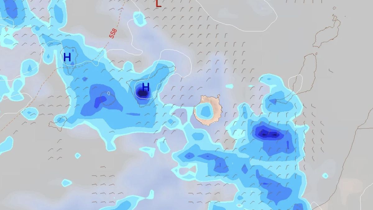
There is no let-up in the weather for the Canary Islands, even during Holy Week. Following the low-pressure system Therese, which left hundreds of incidents across all the islands, and then an intense though short-lived episode of calima, the archipelago is now affected by a cut-off low (DANA). Although not expected to be very significant, it is already bringing some rainfall. According to forecasts from the State Meteorological Agency (AEMET), after two days of blue skies and sun, rain has reappeared this Saturday and, in some cases, may be accompanied by storms.
Weekend Forecast: Rain and Potential Storms
The European model indicates that these showers could occur throughout the day across all islands, first in the western islands and then in the eastern ones by the afternoon. As a significant phenomenon, AEMET notes that occasional storms cannot be ruled out on the islands with higher terrain during the first half of the day.
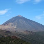
For the mountainous islands, the forecast is generally cloudy with possible isolated and occasional showers during the first half of the day, less likely during the midday and afternoon. From the afternoon onwards, clear intervals are expected in the more western islands. In Lanzarote and Fuerteventura, there will be intervals of cloud with a low probability of isolated, occasional showers around midday.
Temperatures will see minimal changes in the lows. Maximum temperatures will see a slight drop, moderate in the mid-altitudes and peaks of the higher islands. A light variable wind will predominate. In Santa Cruz de Tenerife, minimum and maximum temperatures are forecast at 16 and 22 degrees respectively, and in Las Palmas de Gran Canaria, 17 and 20 degrees.
Outlook for Sunday and Monday
On Sunday, the more eastern islands will see intervals of cloud with a predominance of medium and high clouds. For the rest of the islands, it will be generally slightly cloudy with afternoon development clouds, not ruling out scattered, occasional rain in the western islands, and tending to become cloudy in northern lowland areas by the end of the day. Temperatures will see little change in the more western islands and a slight rise elsewhere, more pronounced in the maximum temperatures on south and west-facing coasts of Fuerteventura and Lanzarote. A light north wind is expected in low areas, turning southerly on the peaks. It will be more intense on the east and northwest coasts of the mountainous islands. Forecasts for Santa Cruz de Tenerife are 18 and 24 degrees, and for Las Palmas de Gran Canaria, 18 and 22 degrees.
Monday will be generally slightly cloudy, except for a predominance of cloudy intervals on the north-facing slopes of the mountainous islands in the early morning and late evening, and inland during the afternoon. In Lanzarote and Fuerteventura, it will be slightly cloudy except for some intervals of high cloud during the day. Temperatures will see little change or slight drops in the maximums in the more eastern islands. A light northeast wind is expected with breezes on southeastern coasts. Forecasts for Santa Cruz de Tenerife are 17 and 23 degrees, and for Las Palmas de Gran Canaria, 17 and 22 degrees.
Further Change Expected on Tuesday
Tuesday will see generally cloudy intervals, being cloudy on the northern slopes of the mountainous islands where weak rainfall is expected, which could be persistent. There is a low probability of weak, occasional showers in the more eastern islands. Minimum temperatures will see little change and maximums will see a slight drop, more pronounced in inland areas. A moderate northwesterly wind will initially veer to northeast during the day with some periods of strong wind on southeastern and northwestern slopes during the second half of the day. Forecasts for Santa Cruz de Tenerife are 16 and 22 degrees, and for Las Palmas de Gran Canaria, 16 and 21 degrees.
Fuel spill prompts marine pollution alert in Gran Canaria

Tuesday: Strong winds and a calima haze
Monday: summer sun, strong winds, and calima aloft
Tenerife weather: stable Sunday with calima and strong winds

Sunday: Saharan dust and gusty trade winds

Saturday: calima and strong winds for the weekend
Tenerife volcanic traffic light not needed, says minister

Thursday: Heat and strong winds across the Islands

Wednesday: warmer weather across the Islands