A welcome cooldown
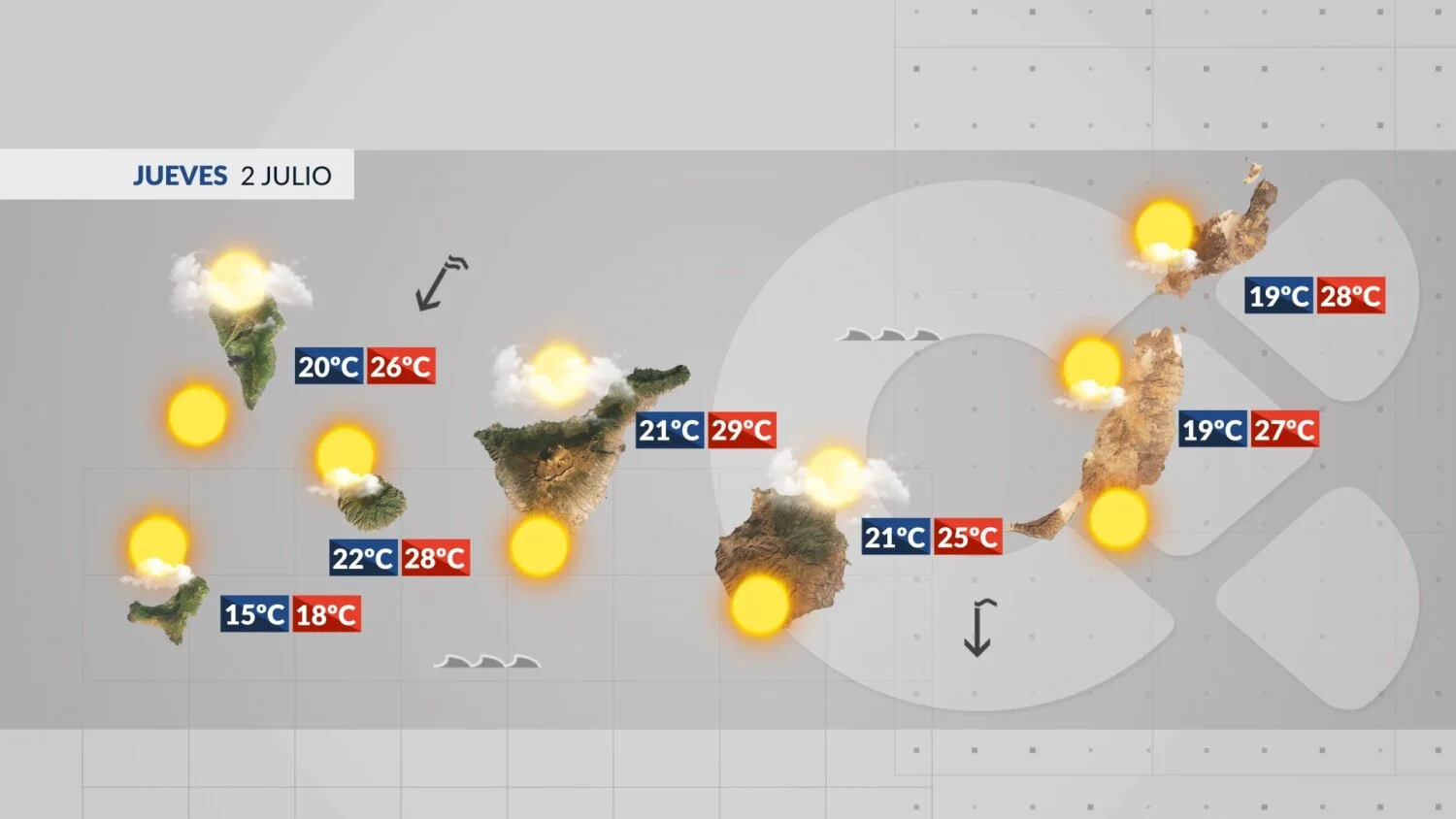
The Saharan dust is gone, the winds are easing, and temperatures are dropping. After a few days of intense heat, Thursday brings a return to more typical summer conditions across the Canary Islands.
Afternoon highs will still nudge 30°C in some southern spots, but overall the mercury is sliding downwards. The Atlantic remains mostly calm in the south, with rough ocean conditions in the north where waves could reach nearly two metres.
Island-by-island forecast
Tenerife
Low clouds will linger in the north and around Anaga early and late in the day, climbing a little higher on the slopes by afternoon. The south stays mostly clear. Winds ease noticeably by afternoon. Temperatures range from 22°C to 29°C.
Gran Canaria
A classic “panza de burro” (low cloud bank) sits over the northern half of the island early on, with a slight chance of a stray drop in the midlands. The rest of the island is clear. Winds weaken and temperatures fall slightly.
Lanzarote
Clouds cover the north and west at dawn but break up during the morning. Winds calm down. In Arrecife, expect a high of 28°C and a low of 20°C.
Fuerteventura
Low clouds at sunrise shift away, clearing the east coast first and then the interior. Temperatures sit between 20°C and 28°C.
La Palma
Low clouds in the north and northeast during the morning and again later in the day, but the coast stays clear for much of the afternoon. Winds ease and temperatures feel cooler.
La Gomera
Strong gusts early in the day lose their punch by afternoon. Clouds remain in the north while the rest of the island enjoys clear skies. Temperatures dip slightly.
El Hierro
Low clouds in the north and northeast thin out through the day but return in the evening. Less wind and slightly cooler weather overall.
La Graciosa
Clouds appear at the start and end of the day, with sunny spells in between. Winds ease and temperatures hold steady.
What’s happening in the Canaries – straight to your phone
News, weather alerts and practical updates – direct from the islands, in English. We live here and know what’s going on – before the international media catch up. Everything lands on our WhatsApp channel – no middlemen, no algorithm. Curated for families, expats and travelers.