Calima and Strong Winds Set to Sweep the Archipelago
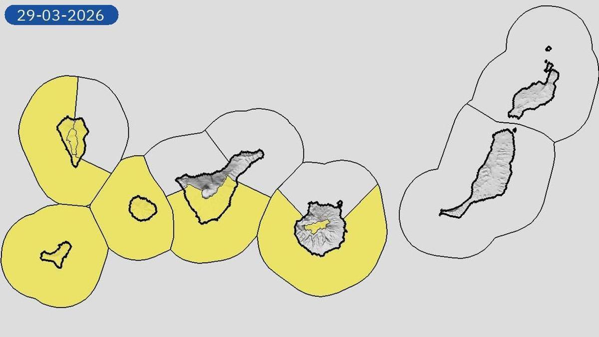
The Canary Islands are preparing for a day dominated by the arrival of calima (Saharan dust haze) and moderate to strong winds, with intense gusts expected in several areas. This combination is likely to impact visibility and air quality across the archipelago. Locally very strong gusts are forecast for high-altitude areas and the north-western and south-eastern slopes of the more mountainous islands. In a notable alert for La Palma, winds in the municipality of El Paso could reach speeds of 90 kilometres per hour overnight.
General Outlook: Clear Skies but Rough Seas
Generally, slightly cloudy or clear skies will predominate, though cloudy intervals are expected in low-lying areas of the north-east of the more mountainous islands, with a low probability of scattered drizzle in the early hours. At sea, a north-easterly force 5 to 6 wind is forecast, increasing to 6 or 7 in the afternoon. A swell or heavy swell will tend towards a rough sea, with a northerly ground swell of between one and three metres.
Island-by-Island Forecast for Sunday
Tenerife
Cloudy intervals in the north with a low chance of drizzle in mid-altitude areas overnight, tending towards slightly cloudy during the day. Slightly cloudy elsewhere. Temperatures with little change. Moderate to strong wind, with very strong gusts on south-eastern slopes and the extreme north-west. Possible frosts on the peaks of Mount Teide. Santa Cruz de Tenerife: 17°C / 24°C.
La Gomera
Cloudy intervals in low-lying northern areas with a low chance of drizzle overnight, tending towards slightly cloudy. Clear skies elsewhere. Temperatures unchanged. Moderate to strong north-easterly wind with very strong gusts in high areas and north-western and eastern slopes. San Sebastián de La Gomera: 18°C / 21°C.
La Palma
Cloudy intervals in the north and east with a low probability of weak rain in the early hours, clearing during the day. Slightly cloudy elsewhere. Temperatures with little change. Moderate to strong wind with very strong gusts, especially in El Paso, where speeds could reach 90 km/h. Santa Cruz de La Palma: 14°C / 20°C.
El Hierro
Cloudy intervals in the north with a low chance of drizzle overnight, tending towards slightly cloudy. Clear skies elsewhere. Temperatures with little change. Moderate to strong wind with very strong gusts on peaks, the extreme west, and south-eastern slopes. Valverde: 11°C / 14°C.
Gran Canaria
In the north, cloudy overnight with a low chance of drizzle in mid-altitude areas, tending to cloudy intervals and clearing during the day. Slightly cloudy or clear elsewhere. Calima is expected at all levels from the afternoon. Temperatures with little change. Moderate to strong north-easterly wind on coasts and an easterly component in mid-altitude and summit areas, with very strong gusts on peaks and south-eastern and north-western slopes. Las Palmas de Gran Canaria: 17°C / 22°C.
Lanzarote
Predominance of slightly cloudy or clear skies. Calima at high altitude which will extend to the surface significantly from midday. Temperatures with little change. Moderate to strong north-easterly wind, with probable very strong gusts in interior areas. Arrecife: 16°C / 22°C.
Fuerteventura
Slightly cloudy or clear skies. Calima at high altitude will affect the surface from midday. Temperatures with little change. Moderate to strong north-easterly wind, with very strong gusts in interior areas and to the south of Jandía during the afternoon. Puerto del Rosario: 16°C / 21°C.

Monday: Strong winds, rough seas, and calima arrives

Calima Alert Issued for All Canary Islands

Sunday: Strong trade winds and a rough Atlantic

Strong Winds to Sweep the Canary Islands This Sunday

Saturday: trade winds and mild temperatures

Friday: Stable weather returns to the Islands

Thursday: calmer Atlantic after the storm

Puerto de la Cruz Businesses Flooded by Storm Therese Deluge

Storm Therese Eases but Yellow Warnings Remain for Five Islands
