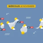
Compiled with the help of artificial intelligence, based on Spanish-language information. Source below the article.
Gran Canaria declares alert ahead of Storm Bruna
The Cabildo de Gran Canaria has declared an alert for rain, storms, wind, coastal phenomena and flood risk from 12.00pm this Saturday, 7 November, following the arrival in the archipelago of the high-impact low-pressure system Bruna. According to forecasts, its effects will be especially intense on the island this Sunday.
The island authority recommends that the public take extreme precautions and avoid unnecessary travel, as well as movement through hills and forested areas, including tracks and footpaths. It has also suspended hunting activity.
Forecasts point to a difficult Sunday
The Directorate of the Gran Canaria Island Civil Protection Plan (PEIN) adopted the measure based on forecasts from the State Meteorological Agency (AEMET). It also takes into account that the General Directorate of Emergencies of the Government of the Canary Islands has activated the Specific Emergency Plan for Adverse Meteorological Phenomena Risks (PEFMA) and the Special Civil Protection and Emergency Response Plan for Flood Risk (PEINCA).
According to forecasts, the rain could be heavy and persistent. It is expected to begin on Saturday night in La Palma and spread eastwards throughout Sunday until it affects all the islands. In Gran Canaria, very heavy and persistent rainfall is expected, above all on Sunday, although the Cabildo does not rule out that it may arrive earlier, on Saturday night. Wind is also forecast in higher areas, especially on the summits, and will intensify on Sunday.
Rough seas and coastal flood risk
Sea conditions will worsen from Saturday, with rough seas and swell of between three and four metres. This will coincide with high tidal coefficients from Sunday to Tuesday and medium ones on Wednesday. According to the forecast, there will be a risk of coastal flooding due to wave surges in La Palma and on the north and west-facing coastlines of the remaining islands. The risk affects bathing areas, promenades and roads close to the coast, especially between two and three hours before and after high tide.
Coordination with councils and emergency services
The Cabildo met with the island’s town councils on Friday to coordinate preventive measures. At the meeting it was agreed to prioritise the inspection and clearing of watercourses and river mouths, the activation of municipal emergency plans and the strengthening of emergency resources. The Island Water Council has provided the municipalities with a map showing the critical points they must monitor, including their location and level of risk. Conservation teams from the Cabildo’s Highways Service are also on alert for possible incidents on summit roads, landslides or surface water accumulation.
The president of the Cabildo, Antonio Morales, has asked the public to exercise caution and stressed the importance of coordination between institutions in order to prevent and reduce the possible effects of the low-pressure system.
What’s happening in the Canaries – straight to your phone
News, weather alerts and practical updates – direct from the islands, in English. We live here and know what’s going on – before the international media catch up. Everything lands on our WhatsApp channel – no middlemen, no algorithm. Curated for families, expats and travelers.


Tenerife weather: sunshine and 26C for Sunday 22 November
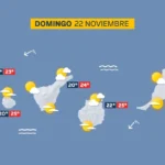
Sunday: sunshine, scattered cloud and a light calima

Tenerife weather: Stable skies and a slight lift in temperatures
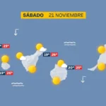
Saturday: sunshine and a calm Atlantic

DGT unveils new colour-coded winter road warnings
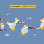
Friday: calm skies and a building Atlantic swell
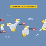
Thursday: scattered cloud and a building Atlantic swell

British man, 23, dies after being pulled from Tenerife sea

Tenerife weather: Sunshine and 27C forecast for Wednesday