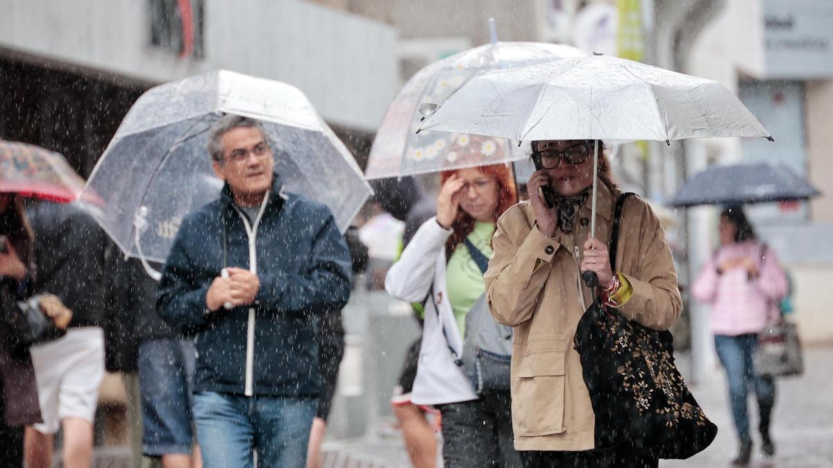
Storm Therese Triggers Archipelago-Wide Alerts
Storm Therese is moving ever closer to making landfall in the Canary Islands. After evaluating the meteorological forecast, which includes several yellow and orange warnings for the next two days, the Canary Islands Government has decided to implement measures to reduce the risks associated with its impact. The prognosis has forced the activation of alerts for winds and coastal phenomena, as well as a pre-alert for rain, flooding, and storms across the entire archipelago starting from this Wednesday.
Forecast for an Intense and Persistent Storm
This extraordinary storm is expected to trigger intense conditions from Thursday onwards. The State Meteorological Agency (Aemet) forecasts that the storm will cause strong wind gusts that could reach 90 to 100 kilometres per hour, heavy rainfall with accumulations of up to 20 litres per square metre in just one hour, and waves of between four and five metres. Combined with spring tides, these waves will batter the coasts and could generate flooding. Furthermore, a drop in temperatures will lower the snow level to between 1,800 and 2,000 metres, causing fresh snowfall on the peaks of Tenerife and La Palma. There is also a chance that this situation will cause mist, which could affect air travel. According to David Suárez, the Aemet delegate in the Canaries, the most extraordinary aspect of this rainy episode will be its “persistence”.
Most Vulnerable Areas to Wind and Coastal Impact
The Directorate of Emergencies has identified the areas most vulnerable to the winds. These will be El Golfo and the area around El Pinar in El Hierro; Puntagorda and Garafía up to the peaks of La Caldera de Taburiente, and from El Paso and Cumbre Vieja down to Fuencaliente in La Palma; from Alojera to Chipude and La Meseta de Vallehermoso, extending across the central peaks of the island and reaching the southeastern coastline from San Sebastián to Playa de Santiago in La Gomera; the northwestern peaks and up to Las Cañadas and El Teide, with the main area of impact extending to Izaña; also the coastline of Santa Cruz and El Rosario, and the peaks of the Anaga massif in Tenerife; and the entire central line of peaks and the high midlands of the northeast, from the peaks of Firgas and Moya to the upper part of the Guayadeque ravine in Gran Canaria.
Regarding coastal phenomena, the most affected areas will be those facing northwest and north. The most dangerous moments will be during high tide, expected from 12:50 to 13:15 today (Wednesday); from 01:00 to 01:25 and 13:25 to 13:50 on Thursday; and from 01:23 to 02:00 and 14:00 to 14:25 on Friday. It is during these times that the risk of coastal flooding in bathing areas, promenades, and roads near the coast will be highest.
A Multi-Phase Storm Event
The episode will have several phases, though the final stages remain less clear. Upon its arrival today, Therese will be accompanied by an initial band of precipitation. “These are not expected to be significant rains,” states David Suárez, who explains that today’s rainfall will be weak or locally moderate. The Canaries will remain on the “southern flank” of this disturbance at least for the first few days.
Tomorrow (Wednesday) this will mean the wind will begin to blow from the west, with gusts that could occasionally reach 70 kilometres per hour and the arrival of the first rains. A deterioration in sea conditions is also expected, which could cause some flooding.
Thursday: Peak of the Severe Conditions
The situation will worsen on Thursday due to the passage of the first of two active fronts reaching the archipelago. “These fronts will have a much greater impact than other similar structures that have affected the Canaries this season, as the centre from which they depart is closer,” Suárez notes. “This first band of precipitation will particularly affect the west of La Palma, but could also leave intense rainfall in the southwest of Tenerife and Gran Canaria.”
Winds will strengthen, potentially exceeding 90 km/h on peaks and the most exposed slopes, which could cause falling branches and trees, as well as damage to property and infrastructure. Simultaneously, coastal phenomena will increase and become more widespread, with waves that could reach five metres. “That’s not exceptionally high, but it coincides with a period of spring tides which could cause some flooding,” reveals Suárez. The same day, an abrupt drop in temperatures will lower the snow level to 1,800 or 2,000 metres, leaving an “abundant” layer of snow on El Teide.
Uncertainty for the Weekend
On Friday, with the passage of a second active front, the instability will continue, with locally heavy and persistent showers and storms on the southern and western slopes of the islands with higher relief. Very strong wind gusts and rough seas are expected to persist. However, as Suárez explains, the situation will gradually improve. “With each band of precipitation that passes, the rain will be less intense,” he highlights.
There is more uncertainty about its potential impact over the weekend, although meteorological models show an increasing probability that the centre of the storm will be located a few kilometres west of the Canaries. However, the movement and depth the storm will acquire is not yet clear. “There is still a lot of uncertainty because the models are changing regarding its position and its deepening, so its impacts could vary,” explains Suárez. While the passage of the fronts is clear, how the storm itself may evolve is much less certain. “There are different scenarios and the impact zones can change, which is why it is important to check the maps and stay attentive to them,” he insists.

Storm Therese Isolates 200 in Gran Canaria as River Bursts Banks

Storm Therese Batters Canaries with Snow on Teide

Storm Therese Hits Tenerife: Essential Driving Safety Tips

Storm Therese to Batter Canaries for Five Days with Wind and Rain

Storm Samuel Set to Batter Canary Islands with Unusual Force

Storm Set to Bring Rain, Wind and Snow to Canary Islands

A Chilly, Wet Start to Spring Forecast for the Canary Islands

Canary Islands Close a Normal, Wet Winter with Record Storms

Weather Warnings Issued for Canary Islands
