Storm Therese Begins to Recede from Tenerife
The worst of Storm Therese has now passed, with weather conditions set to improve gradually over the coming hours. However, the tempest has left intense rainfall across Tenerife, a fresh snowfall on Mount Teide, localised coastal flooding from high seas, power cuts, and a string of incidents caused by landslides and falling objects due to hurricane-force wind gusts. The Island Council of Tenerife provided this update on Saturday, 21 March 2026.
Heavy Rainfall and Significant Snowfall
The heaviest rains were again concentrated in the early hours. Water is flowing through several ravines, particularly in the south and the Isla Baja region, which saw the highest precipitation. The episode has had an uneven but very intense impact, focusing mainly on the southwest and north of Tenerife, where it rained persistently for hours. Rainfall reached very high levels, as forecast by the State Meteorological Agency (Aemet), with 212 litres per square metre in Granadilla de Abona, 200 in Vilaflor, and over 115 litres in areas such as Los Silos, Santiago del Teide, and El Tanque. The intensity of the downpours has led to significant water inflows, such as 1,000 cubic metres of water per hour entering the Trevejos reservoir in Vilaflor.
In the high mountains, the storm brought further significant snowfall early this Saturday morning, with accumulations of around 20 centimetres in the area around Mount Teide.
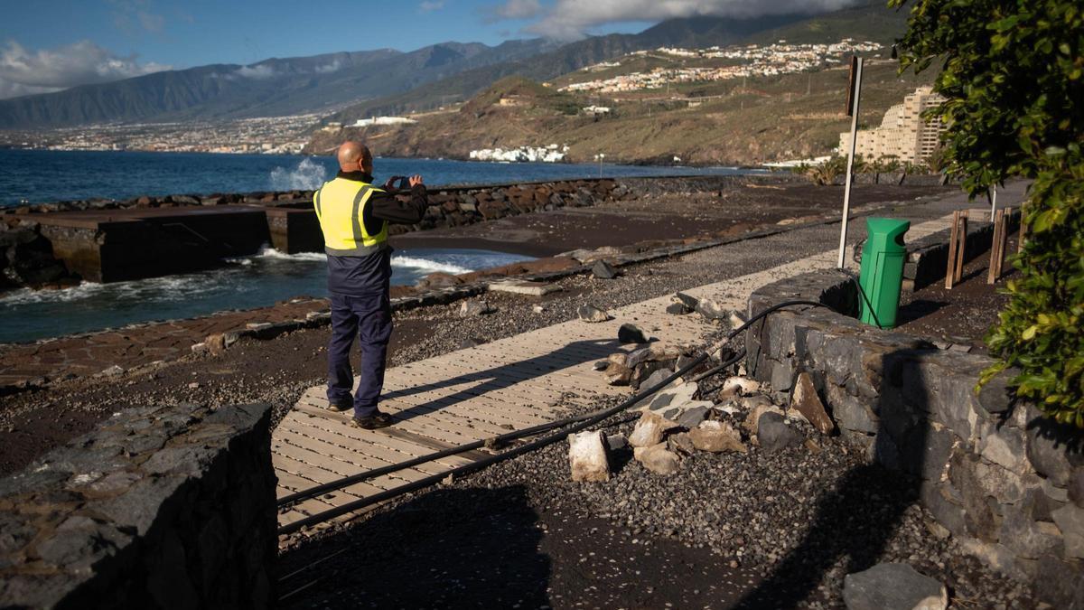
Widespread Incidents and Emergency Response
Wind has been another major adverse factor, with gusts exceeding 200 kilometres per hour at Izaña, contributing to numerous incidents across the island. The approximately 200 incidents recorded are mainly related to falling objects, landslides, flooding in southwestern coastal areas, wind damage, and power cuts in various zones. The storm has also forced the closure of access roads to Teide National Park and the Teno massif, as well as routes like the coastal avenue in Boca Cangrejo, which was affected by a collapse.
The Island Council maintains its activated Insular Emergency Plan (PEIN) and continues to coordinate the large-scale operation deployed across the island following the storm, which left nearly 200 incidents between the night of Friday, 20 March, and the early hours of Saturday, 21 March. A major emergency device remains in place, with over 1,000 personnel activated across all involved services and operational accommodation resources. In this regard, three shelters with a capacity for 100 people have been set up, currently attending to 76 people affected by the storm.
Coastal Evacuations and Continued Vigilance
Residents in Puertito de Adeje also had to be evacuated due to the powerful sea surges battering their homes, which are situated right on the shoreline. The local council has activated the accommodation resource planned for such cases and has signposted the affected areas in El Puertito and El Varadero to prevent risks.
The Councillor for Emergencies, Blanca Pérez, emphasised that the Council keeps all resources active and under permanent surveillance, ready to act on any incident arising from water accumulation or new adverse episodes. According to weather forecasts, the most intense front of the storm has already passed the island, and a progressive improvement is expected from the afternoon and overnight. However, rain could persist until at least next Tuesday.
The Council warns that the next few hours remain delicate, especially due to accumulated water, and insists on the need to exercise extreme caution, avoid unnecessary travel, and stay away from risk areas.

Saturday: Storm Therese brings heavy rain and gales

Storm Therese Disrupts Canary Islands Flights with High Winds

Storm Therese Floods Homes in Adeje, Forces Evacuations

Storm Therese Isolates 200 in Gran Canaria as River Bursts Banks

Storm Therese Batters Canaries with Snow on Teide

Storm Therese Hits Tenerife: Essential Driving Safety Tips

Storm Therese Approaches Canary Islands with Severe Weather Alert

Storm Therese to Batter Canaries for Five Days with Wind and Rain

Storm Samuel Set to Batter Canary Islands with Unusual Force
