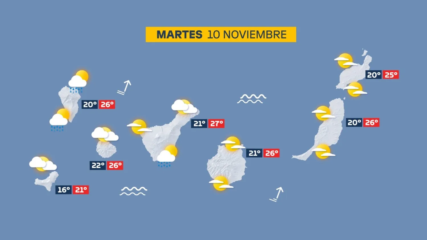
Compiled with the help of artificial intelligence, based on weather data. Source below the article.
Storm Charles is heading for the Canary Islands. Fresh from the passage of Storm Bruna, the Islands face a new Atlantic depression from Tuesday afternoon, named by the Portuguese Institute. Wind is the main threat this time, with gusts expected to top 100 km/h in exposed spots.
Wind, rain and a rough Atlantic
Tuesday starts with high cloud across the Islands and local clouds building through the middle of the day. By the afternoon, the storm brings thicker cloud and showers, which could turn locally intense on La Palma and lighter on El Hierro, La Gomera and Tenerife. Lanzarote and Fuerteventura should stay dry.
Winds will blow from the southwest before swinging west to northwest, with powerful gusts arriving late in the day and overnight. The strongest winds should ease by Wednesday afternoon. Temperatures will hold steady or even climb slightly as Charles passes through.
The Atlantic turns rough, with heavy swell and areas of very rough seas off the north and west coasts. Waves could exceed three metres, so take care along exposed shorelines and promenades.
Tenerife
Cloud builds through the day and may produce a shower or two in the southwest. Winds strengthen in the far northwest, around Anaga and along the east coast. Temperatures unchanged.
Gran Canaria
A calmer day overall, with bands of high cloud and local afternoon clouds. The strong gusts hold off until the early hours of Wednesday.
Lanzarote
Mostly high cloud, with a few low clouds forming over the south-central part of the island around midday. Temperatures in the capital will sit between 20 and 25°C.
Fuerteventura
Plenty of high cloud makes for greyer skies than blue, with low cloud building inland in the east. No wind and no rain. Temperatures a touch lower.
La Palma
The windiest island overnight, with gusts possibly above 100 km/h. Watch for accelerated winds in sheltered downwind areas. Intense showers are possible in the west during the afternoon.
La Gomera
Showers may reach the interior in the afternoon. Expect thick low cloud across the southern half and more scattered cloud to the north, with high cloud elsewhere. Temperatures similar to recent days.
El Hierro
Cloud at all levels, with low cloud inland, especially in the south. Rain is possible in the southwest midlands. Strong gusts arrive in the afternoon.
La Graciosa
High cloud for most of the day and a light breeze. The Ocean turns rough on Wednesday. Temperatures a little lower, tending to rise the following day.