Compiled with the help of artificial intelligence, based on Spanish-language information. Source below the article.
Several low-pressure systems begin to dance over the Atlantic
Several low-pressure systems have begun to dance over the Atlantic. The image helps to explain the Fujiwhara effect, a meteorological phenomenon that can alter the path of low-pressure centres that are close to one another. This interaction helps to make sense of the complex evolution of Bruna, the low-pressure system threatening the Canary Islands with intense rain, storms, wind and rough seas, and which will also affect mainland Spain. The State Meteorological Agency (Aemet) expects Bruna to form this Saturday 7 November to the west of the Iberian Peninsula. Its associated fronts will reach the Canary Islands over the weekend, with the greatest initial impact on the western islands.
What happens when two low-pressure systems approach each other?
Each system has a low-pressure centre around which the air circulates. In the northern hemisphere, that movement takes place anticlockwise. If the systems are close enough, their circulations begin to influence one another and can change direction: at times they spin around a shared point, like two dancers moving in a circle. That movement is known as the Fujiwhara effect. If the two centres are of similar intensity, they may orbit one another for a time. When one is far more powerful, it tends to dominate the interaction and the weaker one may end up being absorbed. It is also possible for them to separate after altering their paths. The name honours the Japanese meteorologist Sakuhei Fujiwhara, who in 1921 studied how eddies interact within a fluid. He demonstrated that two nearby vortices can influence one another and rotate around a shared centre. The phenomenon has been observed in particular between tropical cyclones, but it can also occur between other atmospheric depressions. A relatively small variation in their position changes the course of the fronts and, with it, the areas where rainfall and wind gusts concentrate.
A complex set-up around Bruna
In the environment around Bruna, weather models show several low-pressure centres whose evolution may be shaped by that interaction. However, it is worth distinguishing between a set-up favourable to the Fujiwhara effect and confirmation that a shared rotation or an absorption is actually taking place. The final path will also depend on large-scale atmospheric circulation. Aemet insists that forecasts several days ahead should be interpreted with caution: a shift in the low-pressure system can notably change how the rain is distributed between the islands.
An episode of instability for the Canary Islands
For the Canary Islands, the most immediate consequence is an episode of instability. The forecast issued by Aemet this Friday places the arrival of the heaviest showers in the final hours of Saturday 7, mainly on the western islands. During Sunday 8 they will spread to the rest of the archipelago and may be heavy or very heavy, persistent and accompanied by thunderstorms. The south-westerly wind will pick up, with very strong gusts, especially on the summits of the mountainous islands. Sea conditions will also deteriorate. From Monday, a swell of between three and four metres is expected, a situation that calls for particular caution on exposed coasts.
A possible lull before a second spell
The evolution could unfold in two phases. After the deterioration over the weekend, Aemet envisages a lull during Monday and Tuesday. From Wednesday 11, rain and wind could intensify once again, although the scale of this second episode depends on how the low-pressure centres evolve. The Government of the Canary Islands has declared a pre-alert for storms across the entire archipelago from 9pm on Saturday. According to the emergency services forecast, thunderstorm activity will begin in La Palma and move eastwards during Sunday.
Bruna will also affect mainland Spain
Bruna will also affect mainland Spain, especially from Sunday afternoon until at least Wednesday. Aemet envisages persistent rainfall along the Atlantic side, with totals exceeding 200 litres per square metre in some areas of the west of the Central System and Galicia. Waves of five to six metres are expected on the Galician coast.
What the Fujiwhara effect can and cannot do
There is an important clarification: the Fujiwhara effect does not in itself generate torrential rain. What it can do is alter the organisation and movement of low-pressure systems. The intensity of rainfall depends on humidity, fronts, instability and terrain. In Tenerife and the other mountainous islands, slopes exposed to moist wind can receive far greater amounts than nearby areas. That is why the dance of the low-pressure systems matters well beyond its exotic name. The final position of Bruna and its fronts will determine which islands and slopes receive the greatest totals, how long it rains for and where the wind blows most strongly. Official warnings will be updated as uncertainty around this Atlantic episode diminishes.
What’s happening in the Canaries – straight to your phone
News, weather alerts and practical updates – direct from the islands, in English. We live here and know what’s going on – before the international media catch up. Everything lands on our WhatsApp channel – no middlemen, no algorithm. Curated for families, expats and travelers.


Tenerife weather: sunshine and 26C for Sunday 22 November
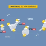
Sunday: sunshine, scattered cloud and a light calima

Tenerife weather: Stable skies and a slight lift in temperatures
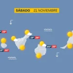
Saturday: sunshine and a calm Atlantic

DGT unveils new colour-coded winter road warnings
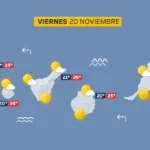
Friday: calm skies and a building Atlantic swell
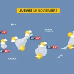
Thursday: scattered cloud and a building Atlantic swell

British man, 23, dies after being pulled from Tenerife sea

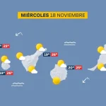
Tenerife weather: Sunshine and 27C forecast for Wednesday