Compiled with the help of artificial intelligence, based on Spanish-language information. Source below the article.
Storm Bruna made its presence felt in the Canary Islands’ airspace, with seven flights that had been due to land in La Palma diverted, and left behind a handful of minor incidents across several islands caused by strong wind gusts and rainfall. Although the front reached the archipelago weaker than initially forecast and the regional government downgraded the situation to pre-alert for rain and coastal phenomena, the day ended up becoming particularly complicated in Gran Canaria, where afternoon storms triggered landslides, traffic problems and small power cuts. The situation even led Telde council to ask residents to remain at home as the rainfall intensified.
No weather warnings active for Monday
For this Monday, the State Meteorological Agency (Aemet) has no active warnings for the Canary Islands, while the Canary Islands government is maintaining the pre-alert for coastal phenomena, wind and storms until further notice.
Seven flights diverted from La Palma
One of the most visible effects of the bad weather came in air transport. Seven flights had to be diverted this Sunday, 8 November, due to adverse meteorological conditions at La Palma Airport. The affected operations connected the island with Tenerife South, Gran Canaria, Munich, Zurich, Hamburg and Madrid. Specifically, four of the aircraft were diverted to Tenerife South Airport and another three landed in Gran Canaria.
The episode also forced changes to the schedule of activities across the archipelago, although in some cases, such as the La Laguna Tenerife CB Canarias match against Asisa Joventut in La Laguna, the game ended up being played in front of spectators because the storm lost strength during the early hours of Sunday.
Bruna will not be the last of the instability
Despite the evolution of the front allowing some preventive measures to be eased, Aemet warns that Bruna will not be the last episode of instability in the week now beginning. For this Monday, 9 November, a relative improvement is expected in the Canary Islands, with cloudy intervals and probable moderate showers at points on the islands with the greatest relief. Rainfall could appear during the first half of the day on the western slopes and move in the afternoon to the eastern and north-eastern areas. Rain could also be recorded in Lanzarote during the early hours. The wind will blow lightly to moderately, although very strong gusts could still occur during the first few hours, especially on the central peaks of Tenerife.
Indeed, this Sunday gusts of up to 109 kilometres per hour were recorded at Roque de los Muchachos, in La Palma, and 107 km/h at Izaña, in Tenerife. The maritime situation will also tend to improve as the week begins.
More heavy rain expected midweek
However, the relative calm could be short-lived. Aemet forecasts that the passage of a new, as yet unnamed, low-pressure system between this Tuesday and Wednesday will reactivate the rain in the Canary Islands. The situation could leave rainfall of up to 100 litres per square metre in La Palma and Tenerife.
Gran Canaria bears the brunt in the afternoon
If Sunday morning was marked by the easing of preventive measures, the afternoon left a more complicated picture in Gran Canaria. Thunderstorm activity became especially noticeable with thunder and lightning in Las Palmas de Gran Canaria from half past three in the afternoon, while in La Aldea de San Nicolás the wind gave way to rainfall and small intermittent power cuts were reported. In addition, at around five in the afternoon, Telde council asked the public to remain at home as the rain intensified.
The island’s roads were also affected and the Gran Canaria Cabildo’s roads department ordered the closure to traffic of a stretch of the GC-200 between Agaete and La Aldea, due to rock and earth falls caused by the rain and wind. The Cabildo announced that during Monday morning it will inspect the road to check whether it meets the necessary safety conditions for reopening. This situation contrasted with the decision taken hours earlier by the island institution, which had cancelled the suspension of all public and private activities and events decreed for Sunday.
Wind causes havoc in Tenerife
In Tenerife, wind was the main feature during the Sunday, sending branches, trees, fences, barrels and traffic signs flying in municipalities such as La Laguna, Icod de los Vinos, Los Realejos, Tegueste, Santa Cruz de Tenerife and San Miguel de Abona. Falling objects on public roads were also reported. In total, the Canary Islands government recorded 16 incidents between Saturday night and the early hours of Sunday, most of them related to the wind.
In La Palma, furthermore, one person was injured after being struck by a chair displaced by a gust. The injured person had to be taken to a health centre. There were also reports of falling trees and bins, landslides on the LP-2 road in Fuencaliente, and concrete barriers being displaced at the entrance to the port of Santa Cruz de La Palma.
Preventive road closures on La Gomera
In La Gomera, the authorities ordered the preventive closure of the CV-14 road in the El Rejo area, while in El Hierro the incidents were mainly related to strong wind gusts. On the eastern islands, Fuerteventura, Lanzarote and La Graciosa also remained on pre-alert, although the front arrived weaker than initially forecast.
Santa Cruz council lifted the restrictions associated with Bruna from 12:00, after the Canary Islands government downgraded the situation to pre-alert for rain, storms and coastal phenomena. Municipal facilities returned to normal operation, although the Municipal Emergency Plan kept its services operational and maintained meteorological monitoring. The council stressed that no incidents related to the storm had been recorded in the municipality.
An uneven picture
The day thus left a mixed picture, with effects on air connections, roads and scheduled activities, and with Gran Canaria the main scene of the complications during the afternoon. A situation which, despite the improvement forecast for this Monday, keeps the Canary Islands watching the skies amid the possibility that the rain will once again gain in intensity in the middle of the week.
What’s happening in the Canaries – straight to your phone
News, weather alerts and practical updates – direct from the islands, in English. We live here and know what’s going on – before the international media catch up. Everything lands on our WhatsApp channel – no middlemen, no algorithm. Curated for families, expats and travelers.


Tenerife weather: sunshine and 26C for Sunday 22 November
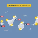
Sunday: sunshine, scattered cloud and a light calima

Tenerife weather: Stable skies and a slight lift in temperatures
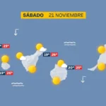
Saturday: sunshine and a calm Atlantic

DGT unveils new colour-coded winter road warnings
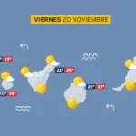
Friday: calm skies and a building Atlantic swell
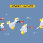
Thursday: scattered cloud and a building Atlantic swell

British man, 23, dies after being pulled from Tenerife sea

Tenerife weather: Sunshine and 27C forecast for Wednesday