Historic Advance for Canary Islands Weather Forecasting
The Canary Islands centre of the State Meteorological Agency (Aemet) has just received the first images from Tenerife’s new weather radar. The activation of this facility, situated at an altitude of 1,343 metres on the Cruz de Gala mountain in the Tenerife municipality of Buenavista del Norte, marks a historic advance that improves the accuracy of weather reports and warnings, particularly concerning rainfall and storms.
Ending a Quarter-Century Wait
It has been a long time coming—over 25 years of bureaucratic processes and construction works costing three million euros—but the second meteorological radar in the Canaries is finally operational. It joins the recently upgraded radar in Mogán, Gran Canaria. With the activation of the tower rising from a peak in the Teno Rural Park, Aemet has solved a serious forecasting problem: the Gran Canaria radar lacked coverage to the west of Tenerife (due to the obstacle of Mount Teide), the northwest of La Palma, and the west of El Hierro. This second electronic system in Tenerife gives Aemet maximum coverage across the entire Archipelago.
Precision and Early Warnings Enhanced
The director of the Western Canary Islands Meteorological Centre, Víctor Quintero, explains that “not only have we eliminated these blind spots in the province of Santa Cruz de Tenerife, but coverage at low altitudes has been expanded with this new radar and the technological improvements introduced in the one we already had in Gran Canaria.” What will these advances mean for weather predictions in the Canaries? Víctor Quintero details that “we can now monitor fronts bringing rain and storms with much greater precision and lead time, which sharpens our reports and warnings to the public.”
“We have much more data for the short-term tracking of these precipitation systems, giving us more information to evaluate their development and anticipate, for example, the formation of storm cells or sudden changes.”
Technical Calibration Underway
Aemet received the certificate of completion for the construction of the Cruz de Gala radar last Wednesday. This officially marked the end of the construction work for this infrastructure. “We have already begun receiving images from Cruz de Gala,” confirmed Víctor Quintero, who clarified that calibration work is currently being carried out so that the radar will shortly reach its maximum level of operability.
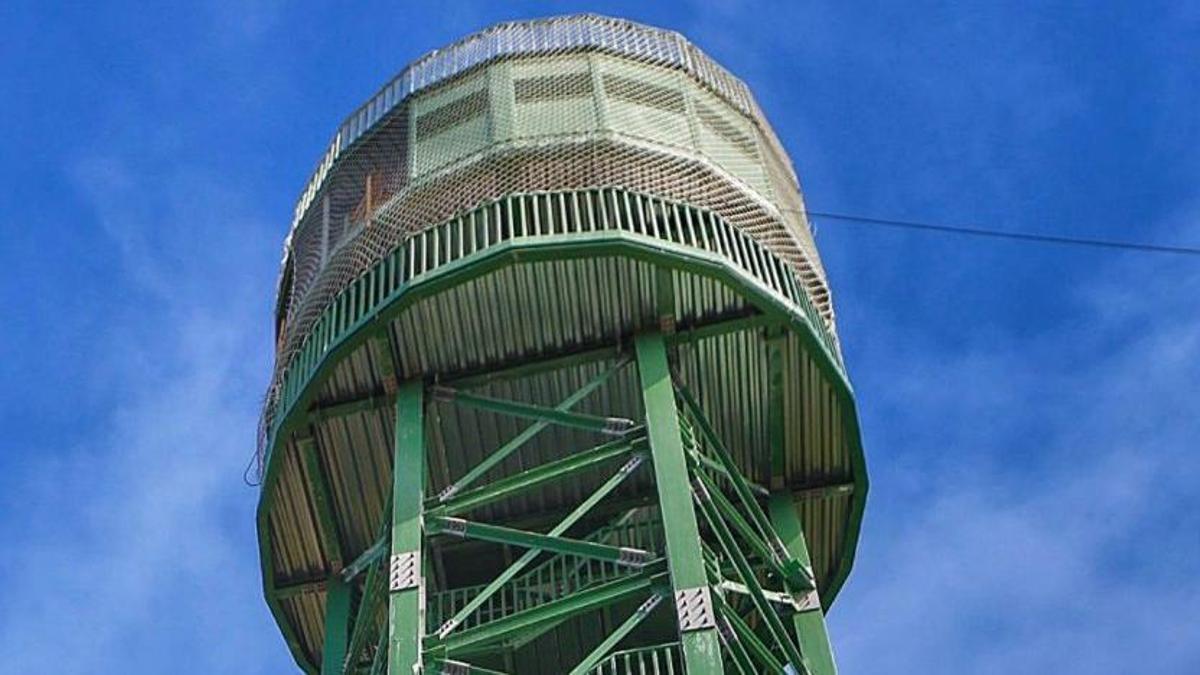
Made of galvanised steel and measuring 5 metres in diameter by 21 metres in height, the tower rising in the middle of Cruz de Gala mountain—camouflaged in the landscape by its green colour—is already sending real-time photographs of fronts approaching the Islands.
A Project Plagued by Delays
The tower and radar project suffered continuous delays. In fact, the first time the need for a second radar in Tenerife, to complement the one at Pico de Los Moriscos in Gran Canaria, was raised was in 2000, 26 years ago. The now-defunct National Meteorological Institute, today called the State Meteorological Agency, warned at the start of this century of the need to install a second meteorological detection system in the northwest of Tenerife.
Aemet revived the plan in 2021 after it was paralysed in 2019 due to problems with the contracted company. Being in a protected natural area, the Teno Rural Park, the plan encountered obstacles beyond those related to the construction firm. These included the 2023 fire that ravaged the Corona Forestal, the increased cost of raw materials due to international factors like the Russian invasion of Ukraine, and complex procedures to obtain the necessary cutting-edge technology.
Dual-Purpose Tower with Cutting-Edge Technology
Aware of the importance of this new radar, Aemet and the Island Council (Cabildo) shifted into high gear in 2023. The new tower, the same green colour as a previous one demolished on the same spot, now operates not only as a radar but also as a surveillance post to monitor mountain safety and detect potential threats, primarily fires—the sole purpose of the old tower that was removed. This means Aemet shares its use with the island corporation, the administration with primary responsibility for controlling the island’s forests.
The new radar can determine the speed at which a storm is approaching and how long it will take to reach the Islands. It can also see what will happen within a 240-kilometre radius, which includes the entire province of Santa Cruz de Tenerife, and allows it to overcome the ‘shadow’ caused by Mount Teide on the Gran Canaria radar, which prevented detection of raindrops from storms approaching the islands from the northwest.
The technological improvement introduced in the two Canary Islands weather radars is based on dual polarisation, a technique that uses two orthogonal orientations (usually horizontal and vertical) to transmit or receive signals simultaneously, doubling data capacity and improving accuracy. It has been incorporated into these storm-chasing sentinels to distinguish types of precipitation. “We will now be able to tell if fronts are bringing rain, snow, or hail, in addition to other parameters that provide more complete information,” specifies the director of the Western Canary Islands Meteorological Centre.
No post found!