Compiled with the help of artificial intelligence, based on Spanish-language information. Source below the article.
Heat to ease as a DANA approaches the Canary Islands
The heat will give the Canary Islands some respite this weekend. The approach of a DANA will shape the All Saints’ Day bank holiday across the Archipelago: on Saturday it will detach itself over the North Atlantic, and between Sunday and Monday it will have settled over the north-west and west of the Islands.
According to the Meteored portal, some showers and storms could arrive ahead of Friday in La Palma, El Hierro, La Gomera, Tenerife and Gran Canaria. The calima will tend to clear for good and the intensity of the rainfall will increase during the central hours of the day.
Sunday 1 November will be the most unstable day
But it will be Sunday 1 November that proves the most unstable day in the Canary Islands. On Monday 2 November, a public holiday in the Canary Islands, the State Meteorological Agency (Aemet) expects the rain to gather strength in Lanzarote and Fuerteventura.
As for temperatures, they will not exceed 29°C on Saturday or 28°C on Sunday, with the municipality of Mogán recording that maximum. On Monday they will drop further, with a maximum of 26°C and a minimum of 16°C, recorded in the municipality of Arona, where there will also be cloudy intervals with thunderstorms.
What is a DANA and why has the term become so well known?
The term has become particularly well known in Spain since precisely two years ago today (29 October 2024), when the catastrophic flooding in the province of Valencia left a toll of 233 people dead, millions in material damage and a picture of destruction beneath the mud.
In the Canary Islands, an apparently similar meteorological phenomenon was experienced during low-pressure system Therese, which left around 600 incidents and six people injured. Though nothing comparable. It was also a low-pressure system of great impact rather than a DANA.
The word DANA stands for Depresión Aislada en Niveles Altos (Isolated Depression at High Levels), and its meaning refers to the drops in pressure that occur in the upper levels of the atmosphere. It is what is commonly known as a “cold drop”, but this expression became distorted and came to be associated with any type of situation involving abundant rainfall, regardless of whether a DANA was involved, so the professional world preferred to avoid its use.
This isolated depression at high levels, whose name pays tribute to the meteorologist Francisco García Dana, who died in 1984, usually causes rainfall over large areas of Spain, accompanied by storms and hail.
A simple way to understand a DANA
To understand it simply, we can imagine a pot of boiling water in the kitchen. That pot is the sea, which is normally very hot and releases constant steam and moisture upwards. If the steam rises freely through the kitchen, it diffuses; but in nature, this forms normal clouds and it rains naturally.
What happens with a DANA is an extreme thermal contrast. The very hot steam collides head-on with the frozen surface. That steam turns into water almost explosively and the moisture in the air is transformed into enormous droplets instantly. That “open tap” at a fixed point, fed by the heat of the sea from below and struck by extreme cold from above, is what ends up causing flooding.
How to stay safe when a DANA is under way
When a DANA is already under way, speed of reaction and sound decision-making are crucial to protecting your safety. To minimise risks, follow these guidelines, organised according to your location:
What’s happening in the Canaries – straight to your phone
News, weather alerts and practical updates – direct from the islands, in English. We live here and know what’s going on – before the international media catch up. Everything lands on our WhatsApp channel – no middlemen, no algorithm. Curated for families, expats and travelers.


Tenerife weather: sunshine and 26C for Sunday 22 November
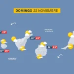
Sunday: sunshine, scattered cloud and a light calima

Tenerife weather: Stable skies and a slight lift in temperatures
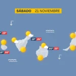
Saturday: sunshine and a calm Atlantic

DGT unveils new colour-coded winter road warnings
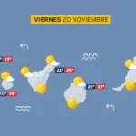
Friday: calm skies and a building Atlantic swell
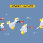
Thursday: scattered cloud and a building Atlantic swell

British man, 23, dies after being pulled from Tenerife sea

Tenerife weather: Sunshine and 27C forecast for Wednesday