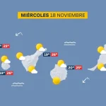
Compiled with the help of artificial intelligence, based on Spanish-language information. Source below the article.
A new dana is threatening the Canary Islands over the All Saints bank holiday weekend. Although stability will hold across the archipelago this Friday, the first day of the long weekend, forecasts indicate that conditions will begin to deteriorate from Saturday onwards. The eltiempo.es website adds that Sunday and Monday will be “the worst days in the Canary Islands”, so it looks as though anyone planning outdoor activities will need to keep an eye on the sky.
Forecaster warns of uncertainty over showers
Meteorologist Mario Picazo explains that there is “a dana to the west of the Canary Islands that could increase rainfall on the westernmost islands”. In his forecast he adds that the archipelago faces greater “uncertainty” because of the arrival of showers.
Saturday: the first showers arrive in the west
The situation will start to become more complicated across the archipelago on Saturday, mainly in the western zone. The dana will bring the first showers and storms to islands such as La Palma and Tenerife, although isolated outbreaks on the remaining islands cannot be ruled out.
Sunday and Monday: the worst days
The eltiempo.es forecast indicates that Sunday and Monday will be the worst days for the archipelago, as the dana will sit to the west of the islands and increase instability. Widespread rainfall is expected across the whole archipelago on Sunday, although it should be lighter in Lanzarote and Fuerteventura. That day, conditions are expected to become more complicated on La Palma in particular, where the State Meteorological Agency (Aemet) plans to activate a yellow warning for heavy rain. The situation will also be especially difficult on Tenerife, in this case because of very strong gusts on the summits.
Monday will bring a similar picture, affecting the western islands from the early hours of the morning and, as on the previous day, proving less intense in Lanzarote and Fuerteventura. Eltiempo.es points to Tuesday as the day when the dana will begin to weaken.
Low-pressure system Austen and the new dana
It is worth bearing in mind that low-pressure system Austen is the phenomenon that has positioned itself to the north of the Iberian Peninsula, with a particular impact on the British Isles. A front associated with it is what has recently swept into the north of the country. However, what is expected in the Canary Islands is a new dana, which will also bring instability.
What’s happening in the Canaries – straight to your phone
News, weather alerts and practical updates – direct from the islands, in English. We live here and know what’s going on – before the international media catch up. Everything lands on our WhatsApp channel – no middlemen, no algorithm. Curated for families, expats and travelers.


Tenerife weather: sunshine and 26C for Sunday 22 November
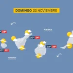
Sunday: sunshine, scattered cloud and a light calima

Tenerife weather: Stable skies and a slight lift in temperatures
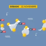
Saturday: sunshine and a calm Atlantic

DGT unveils new colour-coded winter road warnings
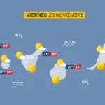
Friday: calm skies and a building Atlantic swell
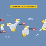
Thursday: scattered cloud and a building Atlantic swell

British man, 23, dies after being pulled from Tenerife sea

Tenerife weather: Sunshine and 27C forecast for Wednesday