Compiled with the help of artificial intelligence, based on Spanish-language information. Source below the article.
Tenerife braces for days of unsettled weather as Storm Bruna approaches
Tenerife is preparing for several days of meteorological instability caused by the passage of Storm Bruna, which will bring intense rain, strong gusts of wind and a worsening of sea conditions across the Canary Islands. The State Meteorological Agency (Aemet) has warned of an episode that could last until Wednesday or even Thursday, with two particularly adverse periods for the Islands.
In a special alert published this Saturday, Aemet states that rainfall will intensify during the final hours of the day in the western islands and will spread to the rest of the Archipelago during Sunday. Around 120 litres per square metre are expected to accumulate in Tenerife, while between 150 and 180 litres could be reached in La Palma.
The episode will be accompanied by westerly and south-westerly winds, with very strong gusts on the summits and the most exposed areas of the islands. The situation will be driven by a large low-pressure system located to the west of the Iberian Peninsula, within which Storm Bruna is sitting.
First bout of rain this weekend
Aemet’s forecast points to a first episode of rain between this Saturday and Sunday. The rainfall will begin in the western islands and advance towards the rest of the Archipelago as the front moves through.
Tenerife: accumulations close to 120 litres per square metre are expected during the episode. The rainfall may be intense and persistent, especially as the front passes through.
La Palma: one of the worst-affected islands, with forecast accumulations of between 150 and 180 litres per square metre.
La Gomera and El Hierro: rain will arrive from the final hours of Saturday and may be locally intense during Sunday.
Gran Canaria: rainfall will spread during Sunday, with a further intensification forecast for the middle of next week.
Lanzarote and Fuerteventura: rain will arrive later, during Sunday, after the front has begun to affect the western islands.
Very strong gusts of wind
Wind will also play a leading role over these days. Aemet forecasts very strong westerly and south-westerly gusts, particularly on the summits and exposed areas of the Archipelago.
Temporary improvement before a second episode
After the rainfall expected over the weekend, the Canary Islands could enjoy a relative improvement during Monday and the first half of Tuesday. However, this pause will be temporary. Aemet warns that rain and wind will intensify again from Tuesday afternoon.
This second episode could leave accumulations of between 80 and 120 litres per square metre in Tenerife and La Palma, with some spots exceeding 150 litres. In La Gomera and Gran Canaria, accumulations of between 40 and 80 litres per square metre are expected, while the remaining islands will also remain watchful of how the rainfall develops.
Wind gusts could reach between 70 and 90 kilometres per hour, with isolated values of between 100 and 120 kilometres per hour in high and exposed areas.
Uncertainty from Thursday onwards
The forecast remains uncertain regarding how the episode will develop from Thursday, although Aemet anticipates a gradual decrease in rainfall. Even so, some heavy showers could persist.
Storm Bruna forms part of a large low-pressure system that will also affect the Iberian Peninsula over the coming days. Persistent rainfall, strong gusts of wind and a significant spell of rough seas are expected there. In the Canary Islands, attention will focus both on accumulated rainfall and on the intensity of the wind and the risk of incidents in exposed areas. The evolution of the storm over the coming week will determine the extent of the second episode of rainfall forecast for the Archipelago.
What’s happening in the Canaries – straight to your phone
News, weather alerts and practical updates – direct from the islands, in English. We live here and know what’s going on – before the international media catch up. Everything lands on our WhatsApp channel – no middlemen, no algorithm. Curated for families, expats and travelers.


Tenerife weather: sunshine and 26C for Sunday 22 November
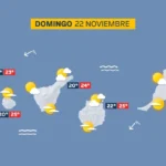
Sunday: sunshine, scattered cloud and a light calima

Tenerife weather: Stable skies and a slight lift in temperatures
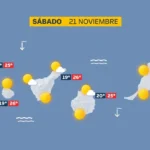
Saturday: sunshine and a calm Atlantic

DGT unveils new colour-coded winter road warnings
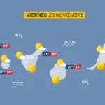
Friday: calm skies and a building Atlantic swell
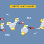
Thursday: scattered cloud and a building Atlantic swell

British man, 23, dies after being pulled from Tenerife sea

Tenerife weather: Sunshine and 27C forecast for Wednesday