Compiled with the help of artificial intelligence, based on Spanish-language information. Source below the article.
Rain alerts remain in place across the islands
Unstable weather will continue across the Canary Islands this Tuesday, with the wettest conditions expected in the so-called Green Islands. According to the forecast from the State Meteorological Agency (Aemet), La Palma, La Gomera and El Hierro could see 30 litres of rain per square metre accumulate in a single hour, with locally heavy showers accompanied by small hailstones and very strong gusts of wind.
The situation is expected to be severe enough that the Canary Islands Government has decided to maintain the rain alert in La Palma, La Gomera and El Hierro, while Tenerife and Gran Canaria will remain on pre-alert. Thunderstorms will also keep all five islands on pre-alert.
The weather is expected to ease during the afternoon, with the forecast now pointing to lower accumulations of 15 litres per square metre between midday and 19:00.
Snow continues on Teide as calima begins to clear
On Tenerife this Tuesday, intervals of medium and high cloud are expected, with the possibility of scattered thundery showers during the early hours. The snow that has left a white blanket on the peak of Teide in recent days will continue to fall above 2,800 metres, although the snow line may drop slightly at times.
During the day, cloud is expected to build, with the chance of occasional, scattered thundery showers inland that could end up affecting coastal areas towards the end of the day. Calima will begin to ease, while temperatures will fall slightly, ranging between 20C and 26C.
The most difficult conditions will come overnight
Across the archipelago, Aemet indicates intervals of medium and high cloud. The most complex situation will come during the early hours, with showers, hail and strong winds. From midday, heavy thundery downpours will still be possible in the interior of the mountainous islands. In Lanzarote and Fuerteventura, isolated heavy thundery showers cannot be ruled out during daylight hours.
As for Wednesday’s forecast, another phase of instability is expected from midday until 19:00, mainly in inland areas of the mountainous islands. Showers and storms could develop in these areas and drift towards the coast, although they are expected to be less intense than those seen in recent days.
Government urges public to follow self-protection advice
In light of this spell of unstable weather, the Canary Islands Government has reminded the public of the importance of following self-protection recommendations. In particular, it asks people to avoid travelling by road wherever possible. If journeys are essential, drivers are advised to use main roads where possible, moderate their speed, increase the safety distance and pay particular attention to the depth of water on the road surface and the state of their brakes.
People should also avoid crossing or parking in ravines, low-lying areas or flood-prone spots, given the risk of sudden flooding and flash floods, even in ravines that are usually dry. During a storm, it is recommended to avoid open spaces, high ground and isolated trees, and to stay away from metal structures and objects that could conduct electricity.
It is also advisable to secure doors, windows and objects that could fall or be moved by the wind, and to avoid activities at sea or in exposed coastal areas while adverse conditions persist. In any emergency, it is essential to alert the 112 emergency services immediately to request help.
What’s happening in the Canaries – straight to your phone
News, weather alerts and practical updates – direct from the islands, in English. We live here and know what’s going on – before the international media catch up. Everything lands on our WhatsApp channel – no middlemen, no algorithm. Curated for families, expats and travelers.


Tenerife weather: sunshine and 26C for Sunday 22 November
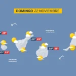
Sunday: sunshine, scattered cloud and a light calima

Tenerife weather: Stable skies and a slight lift in temperatures
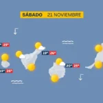
Saturday: sunshine and a calm Atlantic

DGT unveils new colour-coded winter road warnings
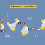
Friday: calm skies and a building Atlantic swell
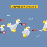
Thursday: scattered cloud and a building Atlantic swell

British man, 23, dies after being pulled from Tenerife sea

Tenerife weather: Sunshine and 27C forecast for Wednesday