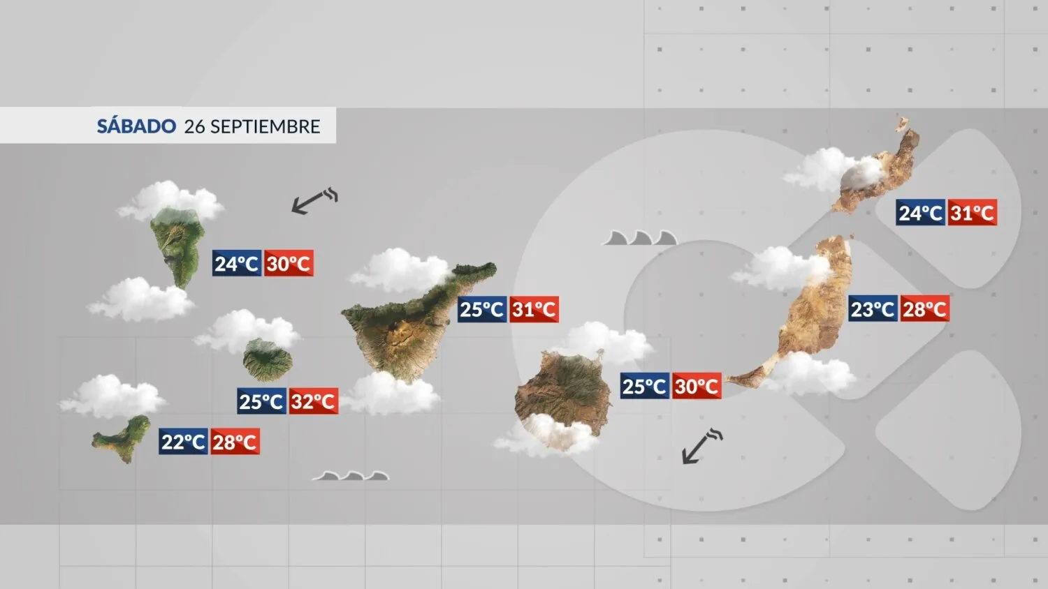
Compiled with the help of artificial intelligence, based on weather data. Source below the article.
Desert dust is back over the Canary Islands this Saturday, September 26, with calima settling across the higher ground while temperatures take a gradual downward turn. The eastern islands will feel the dust most, and the north-easterly wind that has been blowing hard overnight will slowly lose its bite.
What to expect across the Islands
Skies will be covered by layers of high and mid-level cloud for much of the day, with the calima most noticeable over the mid-slopes and summits, particularly on the eastern islands. Temperatures are falling, most sharply in the eastern islands and on Tenerife, though the heat is far from gone: parts of inland and southern Gran Canaria could still reach or nudge past 34ºC, while the rest of the archipelago should climb above 30ºC in places.
The north-easterly wind will blow strongly at times across the south-east and north-west of the mountainous islands during the early hours and first part of the morning, with a few locally very strong gusts possible. It will ease through the day, turning light and variable.
At sea, northern coasts open to the Atlantic face rough conditions, with waves around 1.5 metres. More sheltered southern shores will see a rougher-than-usual ocean, but nothing out of the ordinary for the time of year.
Tenerife
High and mid-level cloud with calima, most significant over the mid-slopes and summits. An isolated shower cannot be ruled out around the Cañadas del Teide. North-easterly wind, stronger in the south-east and north-west, easing and turning variable. Temperatures should reach or pass 30ºC in both northern and southern areas, with Santa Cruz topping out near 31ºC.
Gran Canaria
Cloudy spells with calima in the upper air. North-easterly wind, strongest in the south-east and north-west early on with locally very strong gusts, before easing to light and variable. Inland, southern and north-western areas should hit or exceed 30ºC, with 34ºC possible in spots. Las Palmas will range from 25ºC to 30ºC.
Lanzarote
Cloudy with intervals of high and mid-level cloud and calima in the upper air. Light north-easterly wind and temperatures dropping inland. The south, east and Arrecife should still climb above 30ºC.
Fuerteventura
High and mid-level cloud with calima in the upper air. Light north-easterly wind, picking up inland through the afternoon. Temperatures falling, especially in the west, though the south-east should pass 30ºC. Puerto del Rosario will peak near 28ºC.
La Palma
High and mid-level cloud with light calima, more noticeable over the mid-slopes and summits. Easterly wind easing and swinging round to light and variable. Coastal areas and the capital should reach or exceed 30ºC.
La Gomera
Overcast with high and mid-level cloud and calima in the upper air. North-easterly wind, strong in the south-east and southern half early on with possible very strong gusts, before easing. The south will pass 30ºC, while the capital ranges from 25ºC to 32ºC.
El Hierro
Covered by high and mid-level cloud with calima in the upper air. Moderate north-easterly wind easing. Southern and eastern areas should pass 30ºC, with the north reaching around 30ºC.
La Graciosa
High and mid-level cloud with calima in the upper air. Light and variable wind. Temperatures in Caleta de Sebo will sit between 23ºC and 28ºC.