
Compiled with the help of artificial intelligence, based on Spanish-language information. Source below the article.
The Canary Islands are braced for another bout of intense heat, with every island except La Palma under a yellow warning from the State Meteorological Agency (Aemet) this Thursday for high temperatures. On Friday the warnings will extend to the entire archipelago, while by Saturday only Gran Canaria will remain under a heat warning.
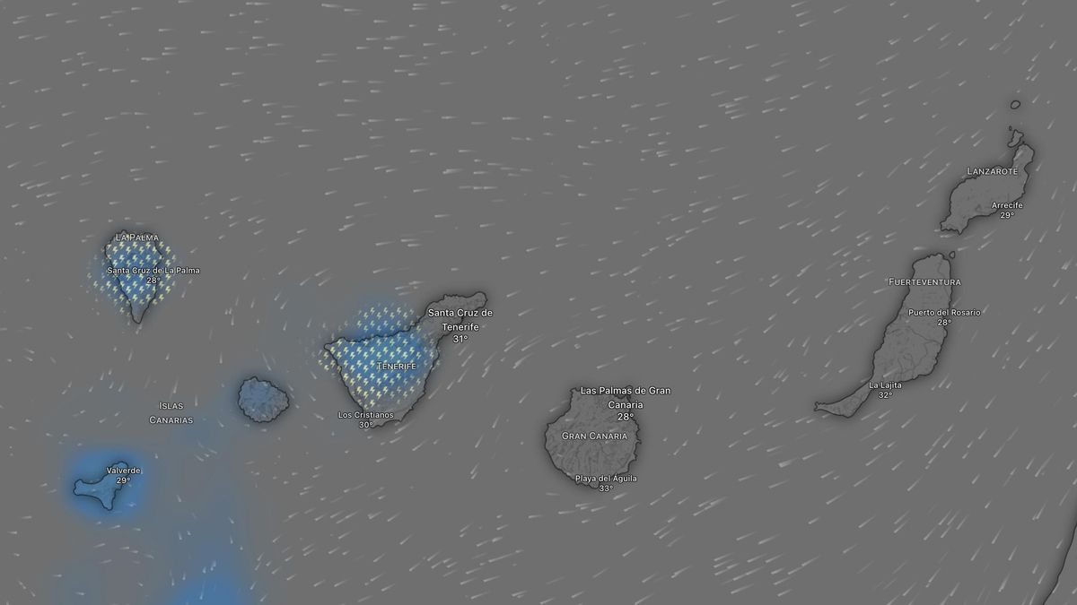
Those high temperatures are not arriving alone, however: they come accompanied by a new episode of calima and, in addition, storms. Aemet has explained that it will be the western islands that receive showers on Thursday and Friday, occasionally accompanied by thunder.
On top of the Aemet warnings, the Canary Islands Government has issued two alerts: one for heat and another for the risk of forest fires. Against that backdrop, this is Aemet’s forecast for the coming hours across the Canary Islands:
Friday
As the most notable feature, Aemet says it is likely that temperatures will exceed 34°C in inland areas and low-lying zones facing south and west, particularly in the south of Gran Canaria. There will also be significant calima in inland areas of the western province.
The forecast indicates high cloud, more abundant in the eastern province, with intervals of medium and low cloud overnight along the coasts of the islands with the greatest relief. Calima will be light, though significant in inland areas of the western islands. Isolated and occasional storms are not ruled out, bringing barely any rainfall, especially in inland areas and most likely in the westernmost islands.
Temperatures will fall slightly in the easternmost islands and change little elsewhere, except for rises in Acentejo, Tenerife, and its surroundings, as well as in low-lying areas of the north and, in particular, in the west of La Palma. It is likely to reach 34°C in low-lying and inland areas facing south and west, as well as on the north-western face of the metropolitan area of Tenerife.
There will be a moderate north-easterly wind, with strong intervals in low-lying areas of the south-east and north-west of the mountainous islands, where locally very strong gusts are not ruled out. In inland areas the wind will be easterly, with very strong south-easterly gusts possible until the afternoon.
Saturday
Abundant high cloud, with intervals of medium cloud. Low cloud will be restricted to intervals during the night-time hours along the northern coasts of the islands with the greatest relief, as well as those of the easternmost islands. Isolated and occasional storms are not ruled out, with little rainfall, most likely in the western province.
Calima will be light, probably more significant inland on the islands with the greatest relief. Temperatures will generally fall slightly, especially the maximums, although it is likely to reach 34°C in inland areas and low-lying zones in the south of Gran Canaria and, more locally, in the remaining low-lying areas facing south and west.
A moderate north-easterly wind, with strong intervals during the first half of the day in the south-east and north-west of the islands with the greatest relief, where locally very strong gusts are not ruled out, easing over the course of the day. On the highest peaks, the wind will be light and variable in direction.
Sunday
Abundant high cloud, with intervals of medium cloud. Low cloud in intervals during the night-time hours along the northern coasts of the islands with the greatest relief and of the easternmost islands. Isolated and occasional storms are not ruled out, with little rainfall, in the islands of the western province, especially inland.
Calima will be light, probably more significant inland on the central islands. Temperatures will barely change. The 34°C mark will be reached in inland areas and low-lying zones in the south of Gran Canaria, and it is likely in low-lying areas facing south and west, including the north of Gran Canaria and the metropolitan area of Tenerife.
A moderate north-easterly wind, turning easterly in inland areas and on the lower peaks. On the highest peaks, the wind will be light and variable in direction.
What’s happening in the Canaries – straight to your phone
News, weather alerts and practical updates – direct from the islands, in English. We live here and know what’s going on – before the international media catch up. Everything lands on our WhatsApp channel – no middlemen, no algorithm. Curated for families, expats and travelers.

Monday: calima clears and cooler air arrives

Canary Islands weather: Calima and heat to linger into October

Sunday: calima and late storms on the Islands

Super El Niño 2026: The climate threat we can’t ignore

Saturday: calima and a cooler turn across the Islands

Canary Islands swelter through tropical nights above 30C

Friday: storms, calima and a hot finish to the week

Thursday: heat peaks and calima across the Islands

Gran Canaria on fire alert as temperatures soar to 36C
