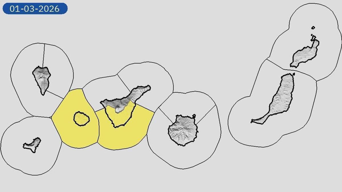
Wind alert remains for three islands
The Government of the Canary Islands updated the situation on Saturday, maintaining a wind alert for La Gomera, Tenerife, and Gran Canaria. The rest of the islands have been downgraded to a pre-alert status. The most significant weather impact is expected on the island of La Gomera and the south-facing slopes of Tenerife and Gran Canaria, as well as in summit areas.
Strong gusts and rough seas forecast
The State Meteorological Agency (Aemet) forecasts cloudy skies in the north of the islands for Sunday, with probable occasional light rain in mid-altitude areas. A slight drop in temperatures is expected on south and west-facing slopes, with a moderate trade wind bringing strong and occasionally very strong gusts. These strong to very strong gusts are predicted for the southeast and northwest slopes, particularly on La Gomera, Tenerife, and Gran Canaria during the first half of the day, though the wind is expected to ease in the afternoon. Sea breezes are forecast for southwestern coasts.
Regarding sea conditions, a north or north-easterly wind of force 4 to 6 will increase to 7 and occasionally 8, with a heavy swell or rough seas. A north or north-westerly groundswell is expected with waves of 1 to 3 metres, increasing to 4 metres north of Tenerife. Showers are anticipated on the north coast of Gran Canaria in the afternoon.
Island-by-island weather forecast
Tenerife
Predominantly cloudy skies in the north with a chance of occasional light rain, mainly in mid-altitude areas during the first half of the day. Slightly cloudy or clear elsewhere. Temperatures with little change or a slight decrease on the southern slope. Moderate trade wind, becoming strong with occasional very strong gusts on southeast and northwest slopes and exposed summits during the first half of the day. It will tend to ease in the afternoon. Breezes on southern coasts. Forecast min/max temperatures (°C) for Santa Cruz de Tenerife: 17 / 22.
La Gomera
Predominantly cloudy skies in the north with a probability of occasional light rain, mainly in mid-altitude areas in the first half of the day. Slightly cloudy or clear in the rest. Temperatures with few changes or a slight decrease on the southern slope. Moderate trade wind, becoming strong with occasional very strong gusts on southeast and northwest slopes and exposed summits during the first half of the day. It will tend to ease in the afternoon. Breezes on southern coasts. Forecast min/max temperatures (°C) for San Sebastián de la Gomera: 17 / 21.
Gran Canaria
Predominantly cloudy skies in the north with a chance of occasional light rain, mainly in mid-altitude areas during the first half of the day. Slightly cloudy or clear elsewhere. Temperatures with little change or a slight decrease on southern coasts. Moderate trade wind, becoming strong with occasional very strong gusts on summits and southeast and northwest slopes, especially during the first half of the day. Tendency to ease in the afternoon. Breezes on southwestern coasts. Forecast min/max temperatures (°C) for Las Palmas de Gran Canaria: 17 / 21.
La Palma
Predominantly cloudy skies in the north and east with probable occasional light rain, mainly in north-eastern mid-altitude areas. Slightly cloudy in the west, with some intervals. Minimum temperatures slightly decreasing. Maximum temperatures slightly decreasing in the west and unchanged in the east. Moderate trade wind, with intervals of strong wind in the extreme northwest and southeast, as well as in the El Paso area in the early hours. Breezes on the west coast. Forecast min/max temperatures (°C) for Santa Cruz de la Palma: 16 / 20.
El Hierro
Predominantly cloudy skies in the north with a low probability of occasional light rain, mainly in north-eastern mid-altitude areas during the first half of the day. Slightly cloudy or clear elsewhere. Temperatures unchanged or slightly decreasing. Moderate trade wind, becoming strong with occasional very strong gusts on the southern slope and extreme northwest during the first half of the day. It will tend to ease in the afternoon. Forecast min/max temperatures (°C) for Valverde: 12 / 15.
Lanzarote
Cloudy intervals, with predominantly cloudy skies in the north and slightly cloudy in the south. Temperatures with little change. Moderate trade wind, with intervals of strong wind during the first half of the day. Forecast min/max temperatures (°C) for Arrecife: 16 / 22.
Fuerteventura
Generally cloudy intervals, with a predominance of slightly cloudy skies to the south. Temperatures unchanged or slightly decreasing. Moderate trade wind, with intervals of strong wind in Jandía during the first half of the day. Forecast min/max temperatures (°C) for Puerto del Rosario: 16 / 22.
No post found!